Midnight Notes . . .
TWO MAPS
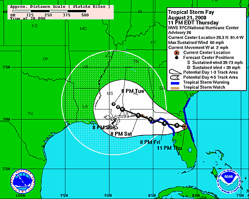
* Note the latest official NHC track forecast. As we have mentioned 50,000 times over the years, it is unwise to base your plans entirely on the thin center line. Note how the “Cone of Concern” flares outward with time.
This track, however, is a bit south of the last one. I wanted to point out Apalache Bay in the NE Gulf. That is the bay that juts inland toward Tallahassee. The track forecast shows that Fay will cross that. If it does, I will have to buy Brian Peters 1/2 of a BBQ sandwich. I have said all along that Fay would not reverse far enough south to get into the Gulf. Brian has contended all along that it just might!
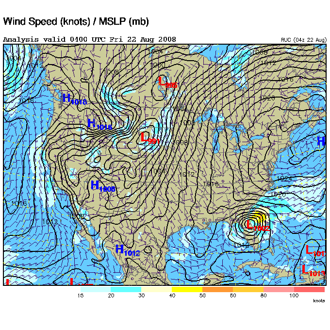
* The second map is a surface map. Note the nice high pressure area north and NE of Fay. There is also a ridge aloft so this has acted as a roadblock to keep Fay from going up the Atlantic Seaboard.
MIDNIGHT IN JACKSONVILLE
Continuing heavy rain, Wind NE gusting to 61 mph.
—————————————————————————————–
Category: Uncategorized


