What Now?
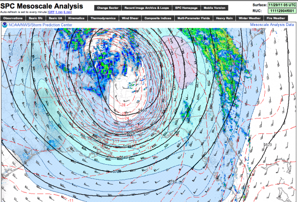
The closed, cold core 500 upper low is over Northwest Alabama late tonight…
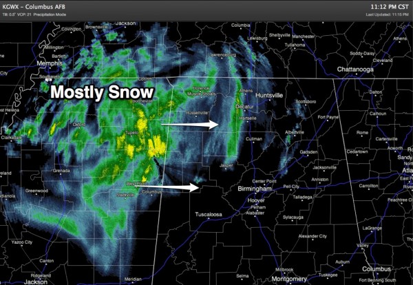
A lobe of energy rotating around the closed low is producing a large area of light to moderate snow over North Mississippi, and that is posted to move into Alabama overnight…
Here are some late answers to your questions…
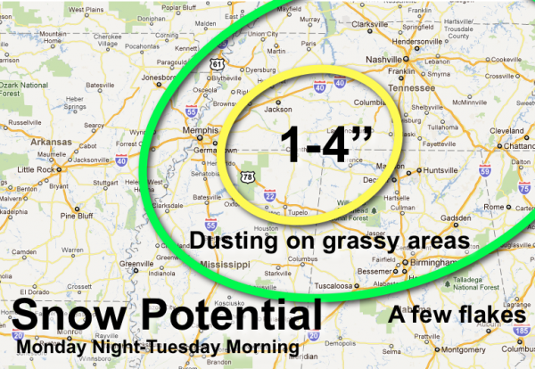
*Will the snow after midnight stick? Yes, mainly over Northwest Alabama. Counties like Marion, Winston, Franklin, Colbert, Lauderdale, Lawrence, and Limestone. But, mainly on grass. Soil temps are in the 50s, and the infrastructure is warm, so roads will be mostly wet.
You might see a little snow on grassy areas around Tuscaloosa, Birmingham, Anniston, and Gadsden, but not much.
*How much snow? See the graphic at the bottom of this discussion, but 1-4 inches could fall on grass over Northwest Alabama, with only a trace to the south.
*Travel problems? Very few are expected. Roads over Northwest Alabama might be a little slushy, but roads will be only wet around Birmingham, Tuscaloosa, Anniston, and Gadsden. And, temperatures will remain above freezing, so no bridge icing to deal with.
*Will I have to go to school? Most likely, yes. The only delay is Walker County; they open at 10. Since we don’t expect any serious travel issues, everybody needs to be ready to run on a regular schedule!
One more thing… these cold core upper lows can bring a surprise or two, so we will keep an eye on things overnight!
Category: Alabama's Weather


