Rina, Is That You?
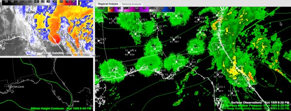
The evolving system east of Florida is getting better organized tonight. It is just southeast of Cape Canaveral.
Moving northwest, the system still has a chance to become a subtropical storm before it makes landfall along the eastern Florida coast. It will cross the Florida Panhandle and could emerge over the northeastern Gulf of Mexico before turning northeast. If it does, it would be named Rina.
The low is already producing sustained tropical storm force winds at Patrick AFB and at Melbourne. Winds gusted to 51 mph at Melbounre last hour.
Irregardless of weather it gets a name, this system will spread clouds, showers and gusty winds into Alabama through Monday night and Tuesday.
Category: Tropical


