Marine storm chase 2 – pictures
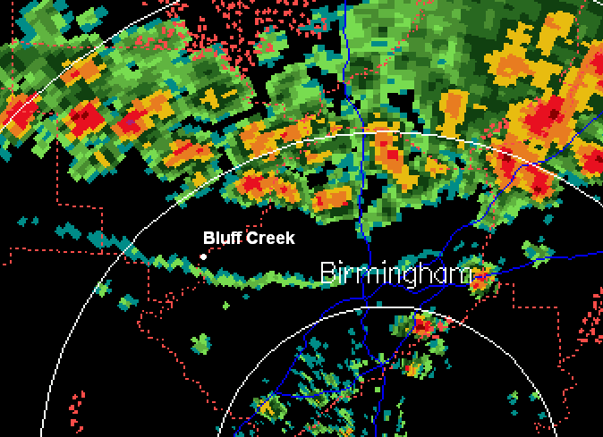
The sharp outflow boundary you see just south of Bluff Creek (our little spot on the Warrior River) came through with very strong winds (there was damage in Walker County). The longer winds have to go over water ( a longer fetch), the bigger waves they can create. Since our cabin faces south, the biggest waves, I figured, would be 1 mile south of our place near Riverwood. So, off to another boat storm chase (there was no lightning at the time). Here is a series of pictures, some from land and some from water. The pictures are numbered, with descriptions at bottom of this blog post.
Picture 1 is looking south from Bluff Creek around the time of the radar picture. That is the cloud along the outflow boundary. In Picture 2, there were clear skies overhead between the outflow and the storms to the north. Picture 3 shows Jack (our little dog) looking concerned out the window. 4 shows my hurricane flag. 5 shows waves with large white caps coming out of Bluff Creek, a slough with a straight fetch of only about 300 yards. In 6, I’m heading down the river (south bound). In 7, I’ve reached Riverwood. The waves are large, and some splash over the front of the boat like in “Deadliest Catch” (note th spray). 8 and 9 show the almost ocean-like waves in the river. 10 shows the southbound barge I met coming back. With that wind at this back, he didn’t need much propulsion!
Category: Pictures, Severe Weather


