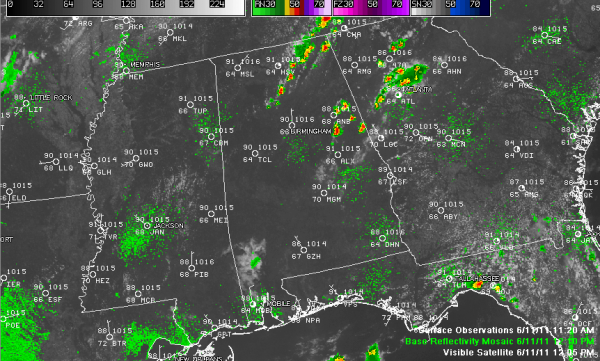
Showers and Storms Forming
Storms started firing across North Georgia before lunchtime today, and it looks like they are starting to go off like a string of firecrackers into East Central Alabama now as well.
Other storms were forming over North Central into Northeast Alabama, from Cullman County northeastward into Jackson county.
So it appears that we should see a healthier dose of storms again today, like yesterday. Everyone won’t get rain. In fact, the coverage will only be about 20-30%.
Some of the storms could produce hail and there is an isolated threat of some wind damage. Of course, they will be accompanied by brief heavy rain and dangerous lightning.
The North Central Alabama storms are pushing southeastward along a boundary that is really visible only on radar. The East central Alabama storms ar pushing south southwestward.
Temperatures are heading toward the 90s again, as they have for 15 straight days. Readings by late morning were running a degree behind yesterday at Birmingham, when it was 97F. So highs between 94F and 96F look good unless you get a shower earlier.
Category: Alabama's Weather


