Memphis Under the Gun
Watch live overage from WMC-TV in Memphis here.
A severe thunderstorm with rotation is crossing northern parts of Memphis right now, heading toward Millington. This circulation has weakened a bit, but could be recycling. Half dollar sized hail was reported near Arlington, which is in advance of this big storm.
Two trucks blown over on I-40 at Marion from this same storm.
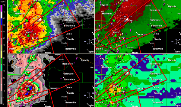
Another dangerous storm is passing south of Tunica MS right now…a tornado was reportedly forming a short while ago near Lula. This storm is moving toward Senatobia.
LATE REPORT: Power lines and mobile home damage was reported at Friars Point MS, which is north of Clarksdale and south of Helena AR (across the Mississippi River) at 6:40 p.m
Here is that storm…
TORNADO WATCH EXTENDED EAST
The tornado watch has not been extended eastward all the way across northern Mississippi to the Tupelo and Iuka areas, including Amory and Aberdeen. It does not include Columbus MS.
THREAT TO NORTHWEST ALABAMA
The storms south of Memphis could reach extreme Northwest Alabama in the Florence/Muscle Shoals area around 10 p.m. if they hold together.
Category: Severe Weather


