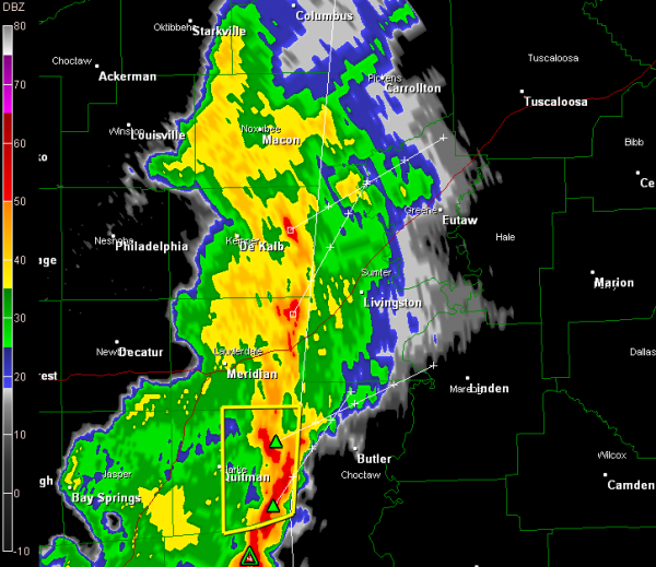
Storms Entering West Alabama
Storms are entering West Alabama’s Sumter and Choctaw Counties.
The storms entering Sumter County have weakened a bit and are no longer severe but are still packing a punch with gusty winds, heavy rain and lightning. Areas from Geiger to Emelle to Livingston, York and Cuba will experience these storms shortly. They will also be into Greene County in about 30 minutes.
North of that, storms are also pushing into Pickens County.
South of that, severe thunderstorm warnings are in effect for in Mississippi, west of Choctaw County. These storms have more intense lightning, some hail and the potential to produce damaging winds. They will affect areas from Lisman to Pennington down to Butler, Needham, Gilbertown and Silas in Choctaw County as they move toward Marengo and northern Clarke Counties.
The airmass over Central Alabama is relatively unstable, with CAPE values running 500-1000 j/kg, with 1000-1500 j/kg already over South central Alabama around Montgomery. It will continue to become more unstable all day and showers and storms will form again, especially this afternoon. Some of them will be strong to severe with damaging winds and hail possible. We also can’t rule out the prospect of a couple of isolated tornadoes as well.
Category: Alabama's Weather, Severe Weather


