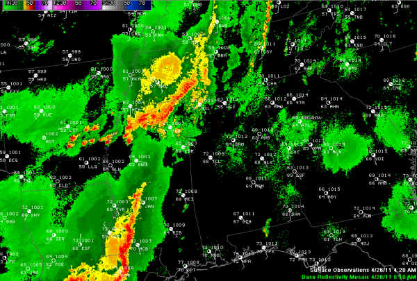
Quiet at 5 a.m.
Fairly quiet at his hour…
Thunderstorms continue moving east northeastward across the northern quarter of Mississippi.
None of them are severe, but they are producing loads of heavy rain and lightning.
A severe thunderstorm watch does continue for northern and northeastern Mississippi.
It is warm and humid across Central Alabama with temperatures in the lower 70s to upper 60s and dewpoints in the middle 60s.
The Mississippi storms will push across the northwestern part of Alabama over the next few hours. More storms will form later today in a fairly unstable airmass across Alabama. Despite weak wind fields, severe storms will be possible, with hail and damaging winds the main threats. Can’t rule out an isolated tornado though as well.
More showers and storms will form over Mississippi today and move across mainly northwestern Alabama tonight and early Wednesday. Severe weather will be possible and heavy rain and flooding will become a big threat.
The main action will come tomorrow as widespread storms form by afternoon across Alabama ahead of a cold front. The SPC has the northern half of Alabama in a moderate risk area tomorrow and warns that an outbreak of tornadoes is possible across Alabama and the Mid-South.
We will get a better idea of the threat as we move toward Wednesday morning, but all Alabamians should be on top of their severe weather game for the next 48 hours.
Think about your severe weather safety plan and be ready to implement it on a moment’s notice.
Don’t worry, just be prepared. We will have the latest information on the blog throughout the event.
James will be along with the morning Weather Xtreme Video within the hour.
Category: Alabama's Weather, Severe Weather


