
Gravity wave update, MCV
As James and JB have been discussing, what looks like a ducted gravity wave is moving along the back edge of the rain area coming through NW Alabama this afternoon. Basically, the air sinks and warms quickly in the trough of these waves, drying up the rain and causing the pressure at the surface to drop very quickly. Winds flow into this area of low pressure, and when the wave moves slowly like this one is, that is an ideal set up for high winds, according to research done previously and expanding on by our group at UAH. See numerical simulation below.

When the wave trough passed the GWX Doppler radar north of Columbus, MS, the radar detected winds in excess of 56 mph just 2,000 feet off the ground.

The wave currently extends from near Arley to Jasper to Aliceville, and with a strong temperature inversion in place, the wave may continue to hold together for a while longer, bringing the threat of winds over 50 mph and downed trees and power lines.
The other neat thing going on this afternoon is a Mesoscale Convective Vortex (MCV), centered near Demopolis. Take a look at the radar reflectivity loop:
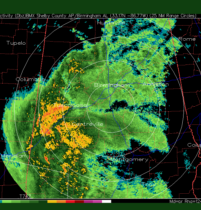
Notice the circular motion to the rain in that area, and an area of lighter rain in the middle. This is actually rain being thrown out of the middle by centifugal force due to the rotation. These circulations are fairly uncommon, and occur when an area of heavy rain and upward motion sits over an area for a while. Air flows in from all directions, the Coriolis force related to the rotation of the earth starts to turn the flow to the right, and a circulation develops. Fascinating.
It even shows up in the velocity image, like a giant mesocyclone. But, these do not represent tornadoes on radar!

Category: Uncategorized
About the Author (Author Profile)
Subscribe
If you enjoyed this article, subscribe to receive more just like it.


