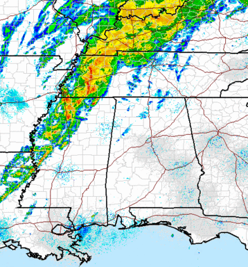
Severe weather analysis – 310 pm
The above data tells part of the story for the severe storms expected across Alabama tonight. The red line is temperature with height, and the green line is dew point. Notice how the moist air (dewpoints this morning in the 60s) only extends up to 900 mb (3,000 feet). Heating has brought temperatures into the 80s, so the air is mixing above that level now, and dewpoints have dropped, despite moist air coming in from the south. The warming and windy conditions are helping mixing dry air down to the surface from aloft. This is one reason we do not expect a big tornado threat across Alabama tonight (maybe one or two, mainly extreme north). The dewpoint at BHM has dropped from 64 at 11 am to 59 now, and may drop some more.
With a cold front and line of storms approaching, we will see heavy rain, hail, and damaging winds. The damaging winds are the big threat here. With the dry air near the ground and all that water falling through it and evaporating, making the air cooler and heavier, downdrafts will be stronger than normal in storms tonight, causing widespread high winds, downing trees and power lines. There is wind shear, but it is not super high, and winds do not change direction much with height, another reason for less tornado risk and more high wind risk.
It is possible that the line to our west could develop into a bow echo at some point, but even if it doesn’t, expect high winds tonight. Have a source of weather information handy.
Category: Severe Weather


