Severe Weather Watches to the West of Us Now
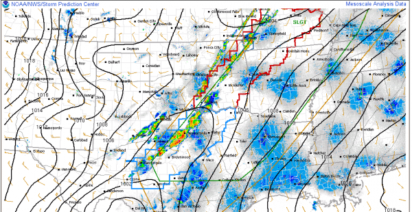
Thunderstorms are erupting tonight as expected from southwestern Missouri through eastern Oklahoma and into North Central Texas. The SPC has responded with a severe thunderstorm watch across Texas with a tornado watch further to the north through Oklahoma, northwestern Arkansas into Missouri.
The storms should congeal into a squall line overnight as the wind fields are generally blowing from the same direction throughout the atmosphere.
This is the activity that we will deal with in Alabama tomorrow. The storms should be near Little Rock by 7 a.m. CDT, near Memphis right before noon and near the Northwest Corner of Alabama by 3-4 p.m. As we have seen recently, these times have to be taken with a grain of salt depending on small scale features.
The storms should be into West Central Alabama around 6-7 p.m. and over to the I-59 corridor around 7-8 p.m.
Severe weather is a threat with the line of thunderstorms as it moves across the state Monday afternoon and evening. Damaging winds and hail will be the primary threats. The tornado threat is small. Everyone should review their safety plans and stay close to a reliable source of severe weather warnings tomorrow.
Category: Alabama's Weather, Severe Weather


