New SPC Severe Weather Outlook
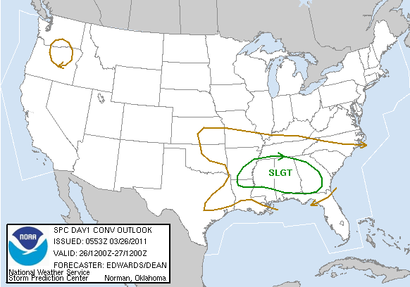
The SPC has chosen to go with an “upper end” slight risk outlook, slightly higher than their standard severe weather risk, for today across much of Alabama, as well as southeastern Arkansas, northeastern Louisiana, much of Mississippi and into western Georgia.
They say there is some uncertainty about various factors for severe weather later today. But they caution that an upgrade to a moderate risk is quite possible this morning.
UNCERTAINTIES REGARDING MORE PRECISE FRONTAL POSITION…BAND
COVERAGE S OF FRONT…PRECLUDE PROBABILITIES SUPPORTING CATEGORICAL
MDT RISK ATTM. HOWEVER…UPPER-END SLGT EASILY MAY BE UPGRADED ONCE
SOME OF THESE UNCERTAINTIES ARE BETTER RESOLVED.
So, no change in the thinking at this point. Severe weather is a good probability later today across much of Alabama, with all modes of severe weather, including damaging winds, large hail and tornadoes possible.
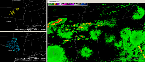
Clockwise from upper left, here are current warnings, radar and the severe thunderstorm watch. Storms are increasing over the Tennessee Valley early this morning, as well as back over North Central Mississippi.
Someone asked about CAPE values for tomorrow. Across Central Alabama, the GFS has them in the 750-1750 range late Saturday afternoon into Saturday evening before they start dropping after dark. That would perhaps put the greatest risk for severe weather in the afternoon hours. We will wait and see.
Category: Alabama's Weather, Severe Weather


