Late Night Check
No real change in the thinking tonight for our pending severe weather threat.
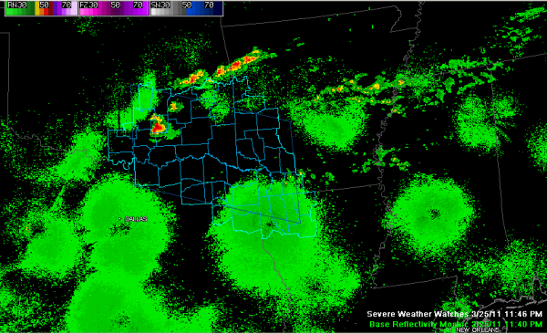
A severe thunderstorm watch is in effect now until 6 a.m. CDT for parts of Oklahoma, Arkansas, Texas and Louisiana. Thunderstorms have begun to fire over Oklahoma and Arkansas as moisture is drawn northward in response to an upper level disturbance that traverse the state. This moisture surge will be led by a northward retreating warm front.
Showers and storms will form along this front Saturday morning. These storms could get quite hairy over the Tennessee Valley.
Highs will be in the 70s and dewpoints will creep back up to the lower and middle 60s by afternoon. With a little sunshine pushing temperatures into the middle 70s. This will yield relatively high instabilities across Central Alabama. A few storms may occur during the afternoon and those could quickly become severe.
The main action should come after 6 p.m. as a cold front begins to approach from the west. Showers and storms will become numerous and some of them will be severe.
All modes of severe weather are possible on Saturday, including damaging winds, large hail and even strong tornadoes. we will be able to be more specific about this forecast early Saturday morning.
Brian Peters will have an updated Weather Xtreme video early in the morning. It will be interesting to see if the Storm Prediction Center upgrades the outlook for Alabama to Moderate. That seems likely.
Category: Alabama's Weather, Severe Weather


