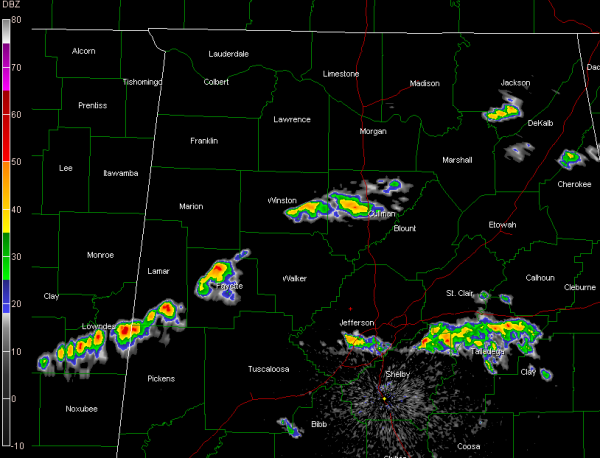
Heavy Showers Ahead of Front
It’s not hard to find the cold front tonight. Heavy showers have developed along it from Cullman County into Winston, then Fayette, southern Lamar and Pickens Counties. Tops on these cells are at about 20-25,000 feet, just short of tall enough to produce lightning. They will produce gusty winds and brief heavy rain.
Other heavy showers extend from southern Jefferson through eastern Shelby into southern St. Clair, Talladega and Clay Counties.
All of the activity is pushing east southeast.
The dewpoint drops precipitously behind the front. The dewpoint reading is 61F at Columbus MS this hour, but only 31F at Oxford MS!
Category: Alabama's Weather


