At The 7:00 Hour
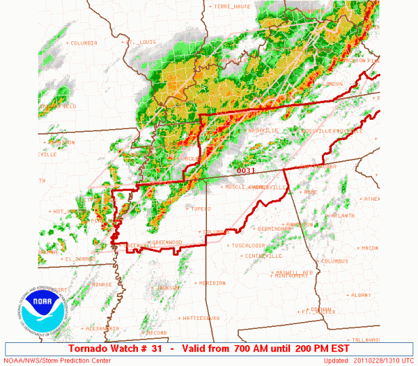
Here is a look at the tornado watch that covers Northwest Alabama until 1:00…
No severe weather is in progress in our state, and we don’t expect anything until after 8:00.
The new data from the morning weather balloon launch is in from the Shelby County Airport… for the weather weenies here is some interesting data…
Helicity 499 m2/s2,
SBCape 778 J/Kg with a forecast temp of 71, modified sounding from 78 degrees SBCape 1595 J/Kg
CIN 0
LI -4
LCL/LFC 2214 ft.
That basically means that parameters are certainly in place for severe weather across Alabama today….
TIMING: Severe weather is possible over the western third of the state anytime from 8:00 a.m. until 2:00 p.m. For the Birmingham metro, the greatest risk will be from around 10:00 a.m. until 3:00 p.m…. and for Anniston/Gadsden the big risk is from 12:00 noon until 5:00 p.m.
Scroll down for much more info…
Category: Severe Weather


