Quiet Across the Nation
ON THE WEATHER MAPS THIS AFTERNOON:
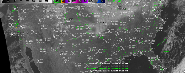
The big picture shows a weakening upper trough over the eastern United States with a big upper level high pressure ridge over Old Mexico building up in the southwestern part of the country.
At the surface, high pressure dominates the landscape, with two big anticyclones over the western region and over the northern Gulf of Mexico.
Nationally, radars are quiet for the most part, with just some light rain and snows over the Mid-Atlantic and Northeast ahead of a shortwave trough moving through that region.
A winter storm warning is in effect for Monday for far northern Maine around Caribou where 8-12 inches of snow is expected.
An Alberta Clipper low is dropping southeastward out of Canada in the rapid northwest flow on the back side of the eastern trough, with high clouds spilling into the Midwest. We will see some of those high clouds later today and tonight, although they will be thinning out a bit as they get to us.
There is a little light rain over eastern Montana and North Dakota, with snows over the higher elevations. A winter weather advisory was in effect around West Glacier in Montana for 2-5 inches of snow, blowing snow and gusty winds. Ahead of that system, my friend Karen Stelmak noted they had record warm lows this morning, including 40F at Belgrade, where she lives.
Along the West Coast, a big storm system will bring heavy precipitation from Washington and Oregon through California this week. Winter storm watches are already posted for the Siskiyous of southern Oregon and northern California, where 9-24 inches of snow is expected Monday and Tuesday.
Otherwise, the National Watch/Warning Map is dominated by only wind advisories across the northern tier of states from Idaho to Iowa ahead of the Alberta Clipper.
Category: Headlines


