Analysis – 814 pm
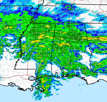
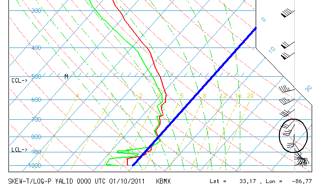
Snow/ice/freezing rain cover most of north and central Alabama. The precipitation has changed over to snow farther south now, over much of Jefferson, Walker, and St. Clair counties, as additional evaporation of water and melting of ice aloft cooled the atmosphere more. The 00Z (5 to 6 pm CST) upper air data from NWS Calera is below.
The red line is temperature and the green is dewpoint. Height is shown in pressure (millibars) at left). The big blue line is the 0 C (32 F) line. Notice that it is above freezing around 820 mb (about 5,000 ft.) Also, the winds are out of the south at 30 knots, bringing in more warm air aloft. That is why some of the precipitation, especially farther south, is sleet or freezing rain instead of snow. The snow vs. mix vs. ice line should move north some more late tonight as the south winds continue aloft, and some additional icing is possible.
Meanwhile, the snow is beginning to accumulate, mainly from I-20 north. Snow amounts will range widely. It looks like precip amounts over south Alabama (MGM, AUB) may not be as bad as originally thought due to a dry slot aloft. This is good news since it may prevent widespread power outages.
Category: Winter Weather


