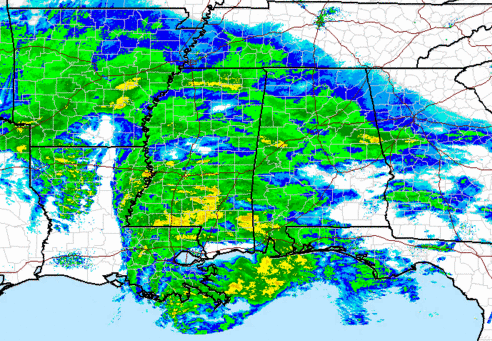
Analysis 445 pm
…EMERGENCY SITUATION IN BIRMINGHAM METRO AND ALL OF CENTRAL ALABAMA…DO NOT DRIVE…
Initial wave of precipitation, associated with an upper-level disturbance out ahead of the main system, has caused big problems in central Alabama this afternoon. Wrecks all over the place.
The atmosphere has already begun to warm up aloft, causing the precip to fall mainly as sleet, but with some freezing rain mixed in (there was ice accumulated on my fence in Trussville when I checked around 435 pm). There is a lot more precipitation to come, as you can see on the radar picture above. And, the amount of precipitation on radar is increasing by hour overall across Mississippi.
As heavier precipitaion moves in later, it may change over to snow for a while, but warmer air will come in aloft again after midnight, causing it to change back to sleet and freezing rain again in areas from I-20 south. Significant icing could occur, and power outages are possible. It might be a good idea to warm your house up some in case the power goes off (I turned my thermostat up to 75).
North of I-20, a major snow storm is expected, with 4-8″ of snowfall. Don’t be surprised if there is some thunder and lightning tonight. For more details on the big picture, you can watch my weather extreme video at
https://www.youtube.com/watch?v=bibyUocNd9k
Category: Alabama's Weather


