Operation White Christmas Watch Underway
Merry Christmas everyone…
What many hope could be a historic Christmas day across North and Central Alabama is underway as snow fans and non-Grinches alike hope for at least an inch of snow where they are today. But it is a day when there is lots of going over the river and through the woods to various friends and family’s houses, so everyone who is doing that will want to stay abreast of the latest conditions lest roads become slick later today and tonight.
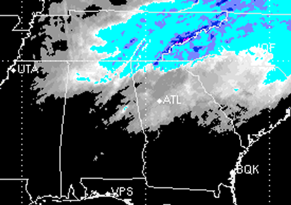
Here is a quick look at the latest run of the RPM model, showing accumulated snowfall between now and 6 a.m. Sunday:
Here is the scale. The grey and white areas represent amounts up to 2 inches, the teal color 2 to 4 inches and blue 4 to 6 inches. We caution that this is one model, albeit one that performed well in the last event and one that fits well with our thinking for how today will unfold.
WEATHER BRIEFING
Here’s what we know at this early hour:
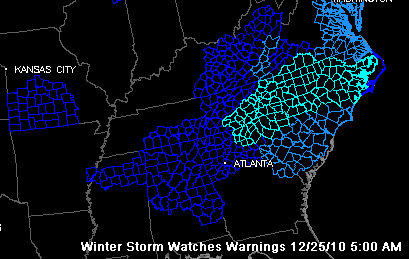
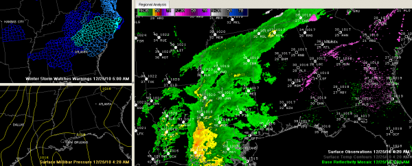
This map shows the area covered by Winter Weather Advisories in Alabama as well adjacent states. A Winter Storm Watch shows up in green from eastern Tennessee into northern South Carolina, most of North Carolina and southern Virginia.
…The National Weather Service has extended the area covered by the Winter Weather Advisory to include the area north of a line from Aliceville to Eutaw to Marion to Montgomery to Brundidge to Eufaula.
…A cold rain is now falling over Northwest Alabama where temperatures are in the upper 30s. It is 37 at Muscle Shoals and Huntsville and 38 at Birmingham. It is 30 at Anniston. Since East Alabama is already below freezing, those counties could see mostly snow.
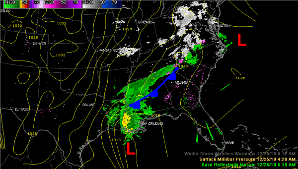
…A surface low is over western North Carolina, with a trailing cold front back through northern Georgia, North Alabama and northern Mississippi. Winds over Mississippi are all out of the north as cold air is moving in behind the front. Meanwhile, a surface low is over the northern Gulf south of Lafayette, LA. This low will spread moisture up into the Southeast as it moves eastward. This is not the classic setup for snow in Alabama, where we have cold air in place with a surface low moving along the Gulf Coast, but it might do in a pinch.
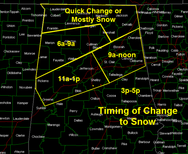
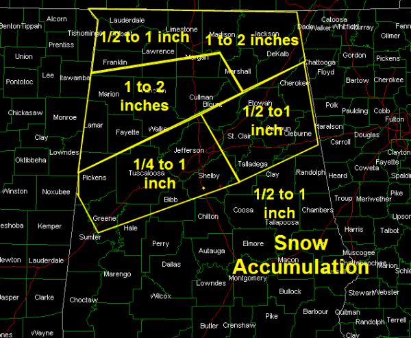
…Rain will change to snow over the northern half of Alabama by tonight and snowfall amounts will total anywhere from no accumulation over southern and southwestern sections to a dusting to 1-3 inches by tonight. Here is a breakdown on amounts and timing…
Here is a rough breakdown of accumulations:
Remember, these are early estimates on the timing and accumulations. We are in the opening minutes of the game and have a long way to go before it is over today. Some folks will be very happy when this day is over, while others will be disappointed. Be prepared for either and be thankful for what you receive.
ROAD ISSUES?
As the snow begins, it will mainly accumulate on grassy areas, roofs, and other raised and exposed surfaces, like decks, steps and most importantly bridges and overpasses. Be alert for slick spots on these surfaces. As it accumulates, roads will become snow covered eventually and will be slick. Hazardous road conditions will develop as this happens, especially as temperatures fall below freezing. This could lead to significant hazardous driving conditions this afternoon, tonight and into Sunday morning in some areas.
Category: Alabama's Weather


