Twas The Night Before Christmas…
And all through the weather office, only a few creatures are stirring, staring at 00Z model data…
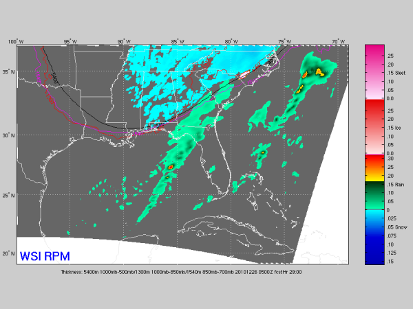
See the 00Z RPM output valid at 11:00 p.m. tomorrow…
Wow… that suggests snow flakes as far south as Mobile and Baldwin Counties… almost to the Gulf Coast. Will this be a Christmas to remember?
The 00Z data set is generally a little more aggressive with the snow tomorrow, and considering radar trends, looks like we will to consider bumping up the expected snow totals across Alabama. I think a good estimate now is for 1/2 to 1 inch, with isolated amounts to two inches, mostly over Northeast Alabama. The low level thickness values remain marginal when we have the best moisture tomorrow, but considering the good setup for convective snow showers tomorrow night into Sunday morning, sure looks like many places across North-Central Alabama will have some coating of snow by daybreak Sunday.
Remember, with any event like this two things will be true:
*There will be surprises
*Some will be delighted, and others severely disappointed with the amount of snow they see
Rain should change to snow during the midday hours across North-Central Alabama, with good potential for 1/2 to 1 inch by 8:00 tomorrow night. Some two inch totals are very possible, mostly across high terrain of Northeast Alabama. Odds of having measurable snow on the ground by midnight tomorrow night are getting better, and our snowless Christmas streak could very well end tomorrow on what could turn out to be an historic day.
Will post another update a little later…
Category: Alabama's Weather


