Watching The Radar
Snow is now falling over the northwest corner of Tennessee, and the rain-snow line is dropping slowly to the south. Rain will begin over Northwest Alabama later tonight as our Christmas winter weather event seems to be unfolding as expected.
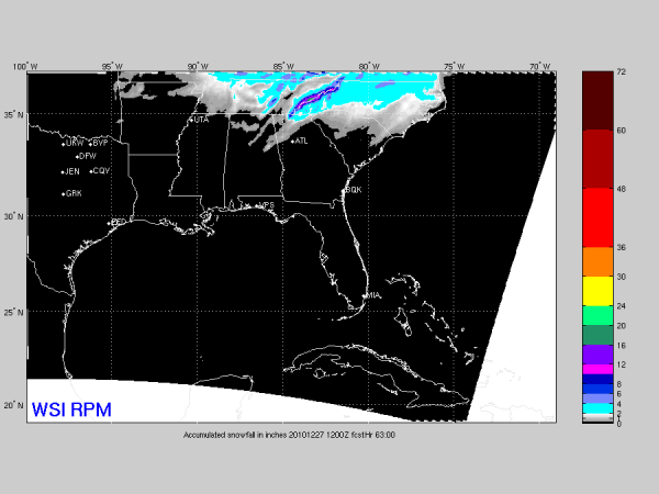
Below is the latest accumulated snow output from the 21Z RPM through the weekend…
Still no reason to change our ongoing forecast of a dusting to 1/2 inch for North-Central Alabama. The change to snow along the I-20 corridor should happen during the early afternoon hours, with periods of light snow, snow showers, and snow flurries continuing into Sunday. The snow showers tomorrow night into Sunday morning can coat the ground in a heartbeat.
Quite frankly, some of the best snow could actually come on Sunday with the instability showers under the cold upper trough.
There won’t be any travel issues during the day, but a few icy spots are possible tomorrow night into Sunday morning on bridges.
I will post another update a little later this evening…
Category: Alabama's Weather


