Late Night Peek
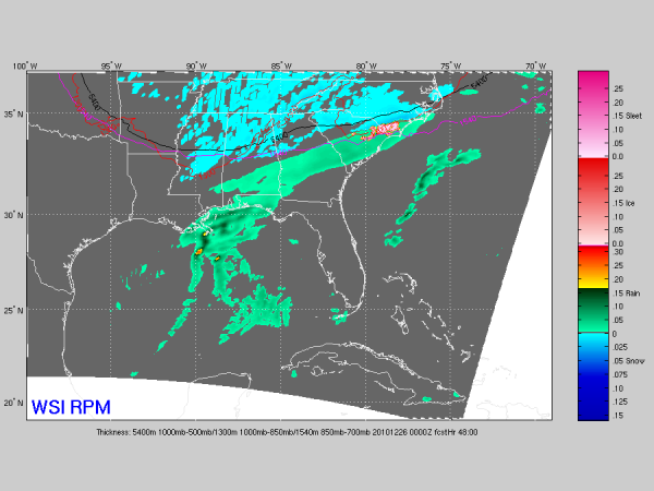
Here is the output of the 00Z run of the RPM model, valid at 6:00 p.m. Saturday…
Remember, this model performed with excellence during the recent ice situation across Alabama a couple of weeks ago, and continues to suggest the possibility of a dusting to 1/2 inch of snow Christmas evening, primarily from the forcing associated with the upper trough. This is certainly not a classic snow storm setup for Alabama with no well defined surface low, but situations like this in the past have indeed made the ground white.
Looks like the main risk of light snow for North-Central Alabama will come from about 4:00 until 10:00 p.m. Saturday. Bottom line is that we won’t be changing our ongoing forecast. I will have a fresh discussion and Weather Xtreme video by 8:00 a.m. tomorrow…
Category: Alabama's Weather


