Watching Radar Trends
A LITTLE UNEASY: Nights like this always make us a little uneasy; a relatively cold airmass in place, an approaching short wave, and a developing low in the northern Gulf. We have mentioned the chance of light rain late tonight and tomorrow morning, with some chance of a few snow flakes over the northern third of the state. But, based on model QPF we have forecasted light precipitation and no serious issues related to weather. But, we all know that things can go wrong with this kind of forecast in this kind of setup.
I am sitting here in the weather office at ABC 33/40 tonight watching the radar loops across the Southeast U.S., and it sure looks like the models might have underestimated the amount of precipitation with this developing storm system. Echoes are well north up into Arkansas and Tennessee, and the rain seems to be increasing in areal coverage over Mississippi.
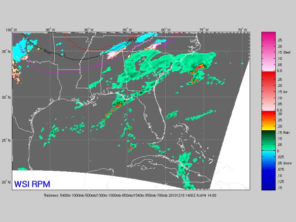
See the output below of the new 00Z RPM, valid at 8:00 a.m. CST tomorrow…

You have to note the wintry precipitation that shows up over the Tennessee Valley at that time.
BOTTOM LINE: Just be aware that there is a chance we might see some kind of surprise late tonight and tomorrow morning. Maybe a little more snow than we bargained for over North Alabama, and heavier rain totals over the central and southern counties of the state. Stay tuned…
Category: Alabama's Weather


