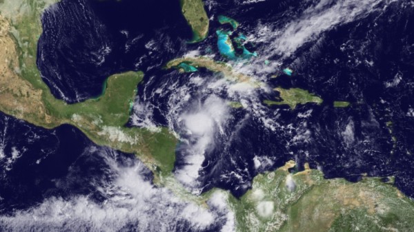
Richard Could Intensify Rapidly Tomorrow
Tropical Storm Richard is tracking to the west northwest off the northeastern coast of Honduras this evening. Top winds are 45 mph.
It will become a hurricane on Saturday. In fact, there is a chance that it will intensify rapidly thanks to low wind shear and warm sea surface temperatures.
Richard will strike Belize Sunday evening and cross the Yucatan, re-entering the southwestern Gulf of Mexico early Tuesday morning. It will then turn to the north and eventually northeast ahead of the trough over the southern states. The good news is that wind shear will be high, probably resulting in Richard dissipating before it can affect the U.S.
Hopefully, the moisture will be drawn to the north over the South, energizing the stalled front and giving us some decent rainfall amounts.
Elsewhere, there are two systems I the Atlantic, one near the Cape Verde Islands and one midway between the islands of the Caribbean and the African coast. The first system still has some chance of developing, but it had better hurry, since it will be moving into an environment that is less conducive. The shower activity with the second system fell apart last night, and it has nearly no chance to grow into a tropical cyclone.
Category: Uncategorized


