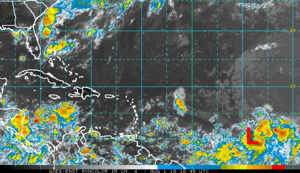
Could Be Colin
Thunderstorm activity has increased with the low pressure system about 1,500 miles east of the southernmost Windward Islands. A tropical depression may be forming and advisories could be initiated as early as this afternoon.
GFS still develops a strong hurricane off the Southeast Coast by late in the week that threatens Florida and the Atlantic Coast by early the following week. Overnight runs of the GFS did move this system toward Miami and the Gulf, but the morning run carries it to off the Southeast Coast south of South Carolina and east of Jacksonville by Tuesday the 10th. It then takes it inland near Jacksonville around the 11th. We’ll just have to wait and see.
This is all based on a system that is still well over a thousand miles east of the islands of the Caribbean and is about ten days away. The GFS does develop a second system in the Atlantic by mid-month.
Category: Uncategorized


