Alabama Weather Update – 12:55 p.m.
Here’s the latest…
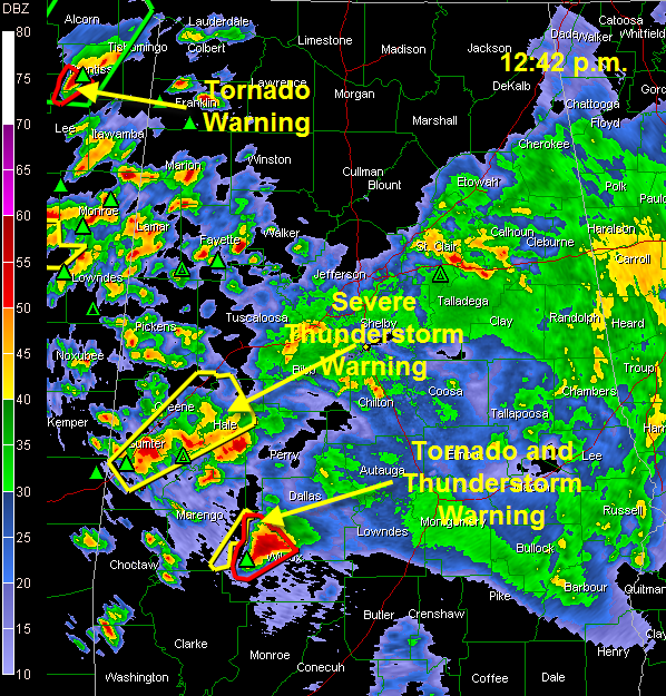
Severe Thunderstorm Warning for Greene, Hale, Sumter [AL] till 1:15 PM CDT…strong storm just northeast of Livingston…moving toward Eutaw and Greensboro.
Still have a possible tornado near Miller’s Ferry in Wilcox County…moving northeast toward Dallas County…should stay just south of Selma…
In Northeast Mississippi, possible tornado passing south of Booneville. This storm could clip the Northwest Corner of Alabama.
Storms seem to be intensifying over Northeast Mississippi and Northwest Alabama. We could see more warnings.
THE YAZOO TORNADO
Numerous reports of significant damage. This tornado is near Lexington MS. It will pass near Ackerman and Starkville over the net hour and a half.
HEADS UP PICKENS/LAMAR/MARION
This tornado is being produced by a long track supercell that could impact West Alabama about 3 hours from now. We want our friends in these counties keeping a close eye on this storm. We also want our friends in mobile homes to start thinking about alternate places to be when this storm approaches later.
TORNADO WATCH TIL 2
Much of Alabama in a PDS tornado watch box until 2 p.m. This watch will undoubtedly be extended into the evening hours.
Category: Uncategorized


