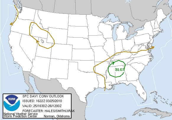
Severe weather?
SPC continues a slight risk for severe weather over northern and central Alabama, mainly for late afternoon and evening. An upper level storm, with cold temperatures aloft, is approaching from the west, and will move into Alabama by early evening. Also, skies will clear over Alabama from west to east, with sunshine returning in BHM in the next half hour.
Once the sun shines, temperatures will climb quickly into the upper 60s or lower 70s. Some of the water evaporating off the ground will allow dewpoints to climb to near 60, making the air somewhat unstable. With some wind shear, we could see another round of thunderstorms late this afternoon or early this evening, and a few could be severe. The limiting factor will be instability. Even though temperatures will be cold aloft and fairly warm at the surface, dewpoints will generally be low, as they have been much of this year so far, due to cold Gulf water temperatures. But, with the wind shear and strong upper-level system, we’ll need to be on alert for severe storms with hail and isolated tornadoes this afternoon. It wouldn’t surprise me if they issued a tornado watch by 3 pm.
Category: Uncategorized


