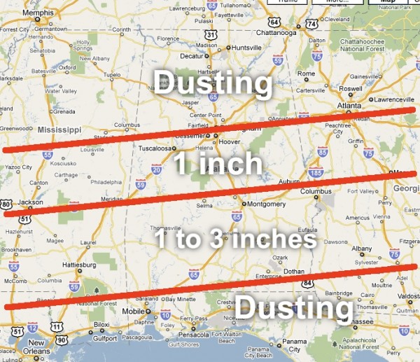
Accumulation Forecast
Here is a graphic that sums up my thinking on Friday’s snow event in Alabama. The ECMWF remains the favored model; the Canadian and the US models are slowly moving in that direction.
I-20 will be on the northern periphery of the system, and dry air over North Alabama will keep amounts very light north of I-20. The best places for good snow accumulation seems to be mostly from U.S. 80 south to U.S. 84. And, I should mention I do think there will pockets down there where more than 3 inches of snow will fall. We can’t specify that right now.
And, of course, south of U.S. 84 that “dusting” of snow will be mixed with rain.
Needless to say, we all know this could change, and snow doesn’t fall in perfect zones like this. With any snow event, some will be delighted with the amount they see, others severely disappointed. And, you all know the forecast can, and probably will change a bit by the time Friday rolls around.
The full afternoon discussion and Weather Xtreme video will be posted by 3:00 or so. Stay tuned…
Category: Uncategorized


