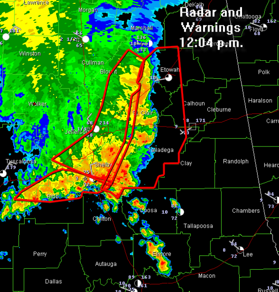
Radar and Warnings

The line of severe thunderstorms is turning southeastward now. It is in the axis of greatest instability.
It is racing southeast now at over 50 mph.
A huge cell merger is occurring now as the main line is overtaking the storms that were preceding it. This will give intense rainfall and the potential for downburst winds to southern Shelby, northern Chilton, southern Talladega and Coosa Counties…be alert.
CAPEs are running 2500-3000 j/kg from Shelby through Chilton into Autauga, Elmore, Coosa, Elmore and Tallapoosa Counties.
The storms will be feeding on this instability.
Widespread wind damage will result. Tremendous amounts of lightning also, as well as flooding from heavy rain.
LATE REPORTS
Emergency mngr reports TSTM WND DMG at 11:45 AM CDT — trees down multiple locations across Blount County. Berry Mountain in Rosa, Sawmill Road east of Blountsville, Pine Grove road in Rosa, and highway 160 w of Hayden.
From Blount Co. EMA: Tree and wires down in road at library downtown Oneonta
Category: Uncategorized


