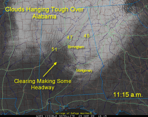
Noon Look at Alabama Weather
Stratocumulus clouds are hanging tough across much of North and Central Alabama at the noon hour.

Those persistent, low gray clouds are wrapping around the big upper low that is beating a retreat through the Great Lakes region now.
They indicate weak convection bumping up against a more stable layer above the feeble instability. They are often seen in the wake of a strong cold front.
Notice how they are arranged in long rows, or rolls, perpendicular to the flow. These rolls form as a result of waves in the flow. Where the air is rising, the clouds form. In the trough, the cloud elements dissipate, creating these rows.
Here is what they look like from my vantage point in Trussville. Notice the patch of blue sky.
Regional radars are free of echoes. Can’t rule out a little light shower over the Tennessee Valley this afternoon, however, but any precipitation should be inconsequential.
Temperatures are still in the 40s in areas that have not cleared. 60s are found where there is sunshine. All areas should get into the 50s eventually as the clouds continue to break up.
Be alert to the possibility of a little light frost tonight as temperatures drop mainly into the 30s under a clear sky with light wind.
Tomorrow promises to be a spectacularly beautiful day.
Tuesday will feature rain and storms.
Wednesday will be another in-between day.
Thursday will be stormy, with strong storms possible.
Look for another big rain event late in the weekend.
Category: Uncategorized


