Big-time water

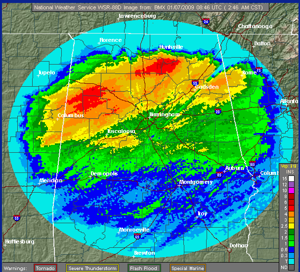
Radar-estimated rainfall since Sunday evening.
The widespread heavy rainfall since Sunday night has caused flooding problems over parts of Alabama. Please scroll down to see a slideshow of flooding pictures sent in to ABC 33/40.
This blog post is more about quantifying the rain, than its effects. When one considers just how much water fell on Alabama over the past 3 days, it is really amazing. It is not unusual to see scattered areas receive 3″ of rain, but the radar estimates above show that an area about the size of 12 counties got at least that much, and a few locations got a lot more. And, these estimates may be on the low side in some areas…I received 4.76″, but the radar only shows 2.5″ at my house.
Doing a rough estimate based on the radar rainfall estimates (assuming they are right), about 2 trillion gallons of water fell on Alabama since Sunday night. That’s 7 billion tons.
All the water that fell is flowing through small ditches and ravines, to creeks, and into the rivers. Some creeks have not crested yet, and all that water has to eventually make it to the Gulf. So, there will be flooding problems at least along the Warrior, Tombigbee, Coosa, and Cahaba Rivers for the next few days. I talked to our friend Philip Cunningham, operator at Bankhead Lock for the US Army Corps of Engineers early this morning, and he told me he had not seen this much water in his 14 years at that job. They have most of the flood gates open, and in combination with Alabama Power are releasing 264,000 cubic feet of water per second at Bankhead Dam. That’s 119 million gallons per minute.
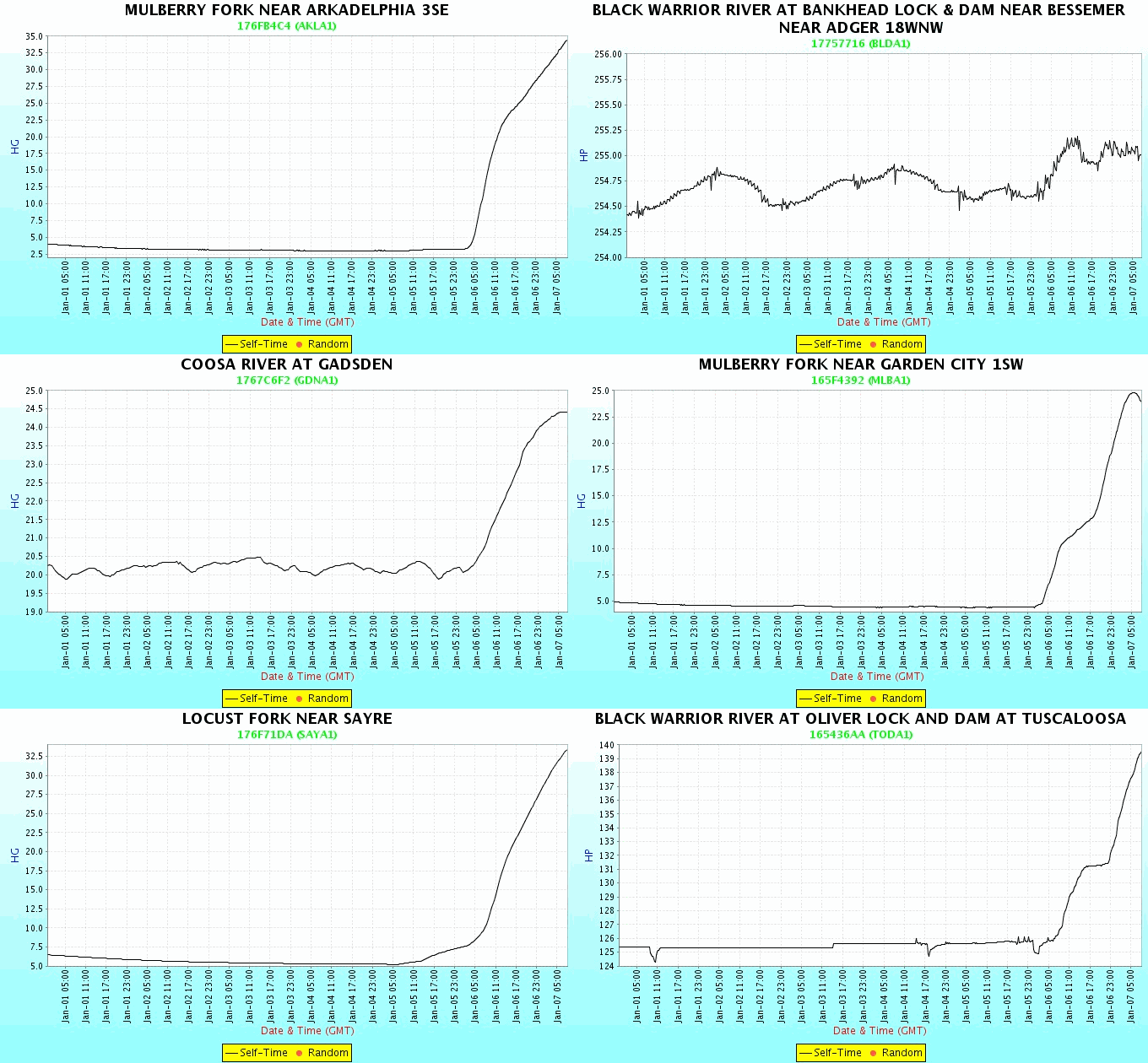
Below is a slideshow of the height of several rivers/creeks in central Alabama since Jan. 1. You’ll note that the Warrior River at TCL rose 6′ during the day, and has risen another 8′ overnight. Some flooding near Rice Mine Rd and River Rd is possible. The Mulberry Fork at Arkadelphia had the most dramatic rise, from 3 feet to 34 feet in one day. Dramatic rises have also occurred at Aliceville, Gadsden, and along the Cahaba.

I’ll be heading to the Warrior River soon to check on my 1973 Manatee boat. Due to barge navigation, our river (Bankhead Lake on the Warrior) is usually very steady, within a 1.5 foot range. We’ll see.
Category: Uncategorized


