Iron Bowl – Close Call
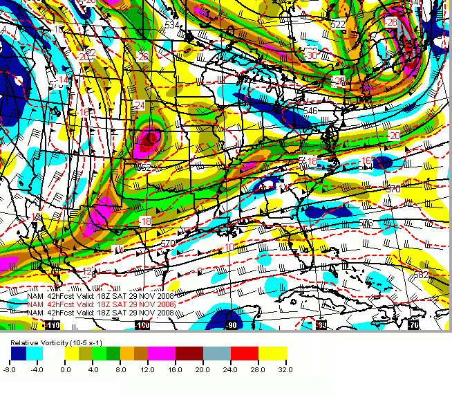
No, I’m not talking about the score (at least not here). Latest model runs available when I’m writing this indicate that the main upper-level system will still be west of Alabama on Saturday, but a lead impulse will move across north Alabama Saturday morning. Here is the NAM 500 mb chart at noon Saturday. (Colors indicate vorticity, or spin in the atmosphere. An area of positive vorticity is called an upper-level disturbance).
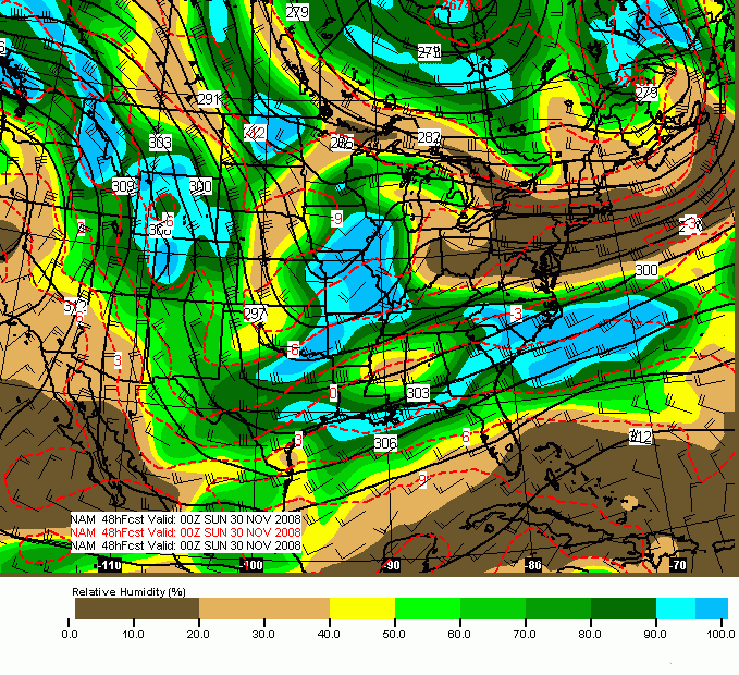
The big influence will be southerly flow, associated with warm. moist air overrunning the cool air in place over Alabama. As it does, it rises and produces rainfall very efficiently. Model consensus between NAM, GFS, GEM, and NOGAPS indicates that this could be a heavy rainfall event, especially in central and south Alabama, with some spots receiving over 2″. Interestingly, the NAM and the GFS call for the heavy rain to abruptly stop late Saturday morning, with a mainly dry period (just some drizzle or light rain only) during the game. Check out 700 mb (mid-level) relative humidity at 00Z Sunday (6 pm Saturday).
There’s a dry area moving over Tuscaloosa Saturday afternoon. The NAM calls for about 1″ of rain tonight, another 1/2″ Saturday morning, and nothing Saturday afternoon. The GFS calls for 1″ tonight, another 1.5″ Saturday morning, then only 0.02″ Saturday afternoon! If this forecast holds, it maybe would just include a wet field and some light rain.
But, models change a lot, and also often have a bias toward moving systems too quickly. So, this one will be a close call. With so much rain, if it is delayed by only 6 hours or so, the game could be the wettest since the 1983 game that was played with tornado warnings in the area. But, the models could be right, and things will be drier. Very tough forecast.
Would rain benefit Alabama, with their solid running game, or Auburn, with its tough defense in a low-scoring situation?
Category: Uncategorized


