My two cents’ worth
The discussion on the blog has gotten me interested in the weekend forecast, also. One thing will continue for at least a while…our colder than normal winter so far (OK, it’s only November).
Some classic dynamic meteorology will occur over the Southeast over the next week or so. A cold front will move through Alabama on Friday, bringing showers and a maybe a few thunderstorms. The front will stall near the Gulf Coast, and a low will form along the front on Saturday, as at least one upper-level disturbance (a wave in the flow, often caused by rapid flow over mountains, etc.) approaches. This system has the potential to really get its act together…bringing in more rain on Saturday for the Alabama-Auburn game, and then very cold air Sunday and Monday.
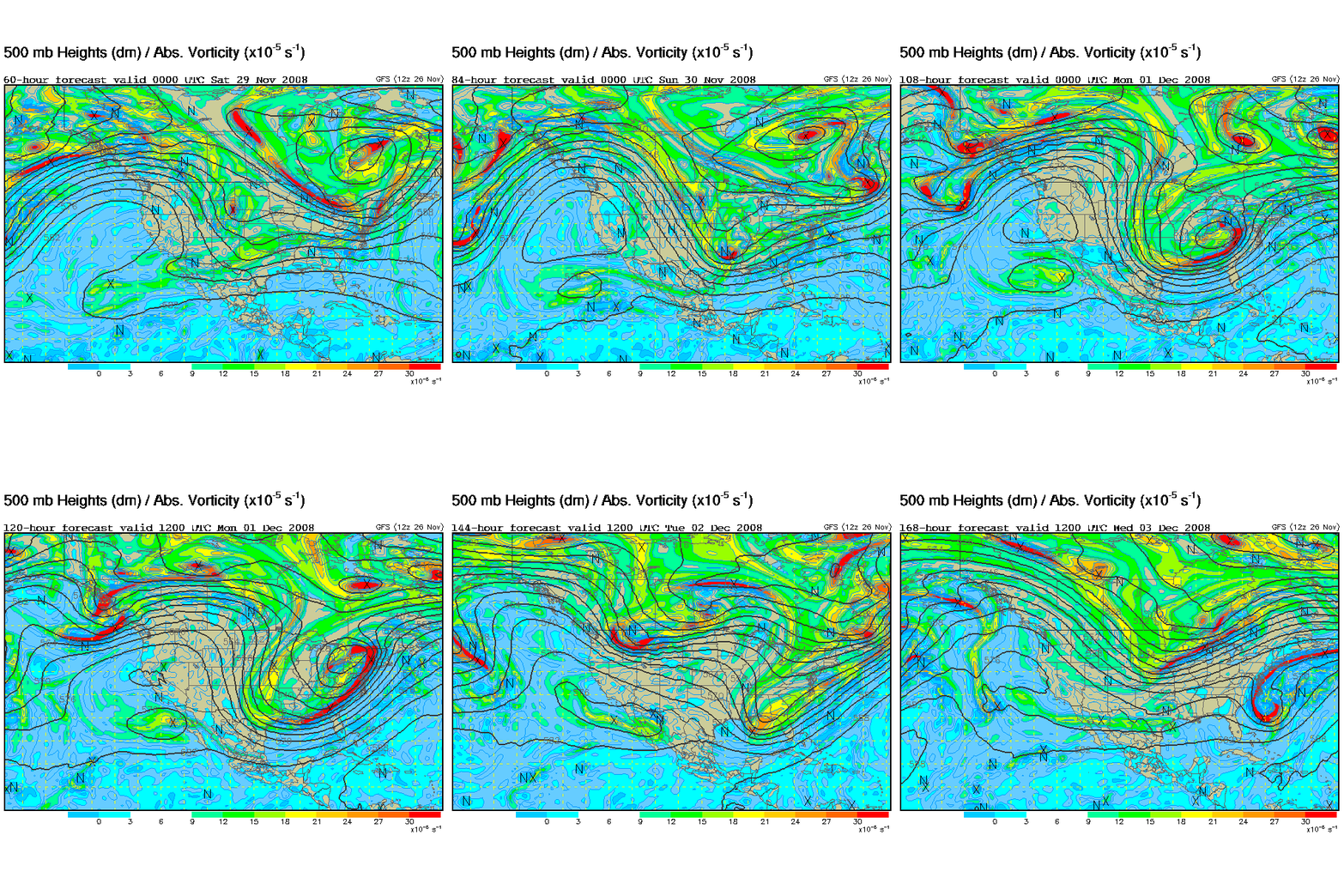
Below is a loop of the GFS 500 mb pattern. Notice the upper-level storm really intensifying Sunday and Monday.

(Click on the map to make it larger and clearer.)
The other models, including the European, Canadian, and NOGAPS also show this pattern, but the GFS may have the upper low farther to the south.
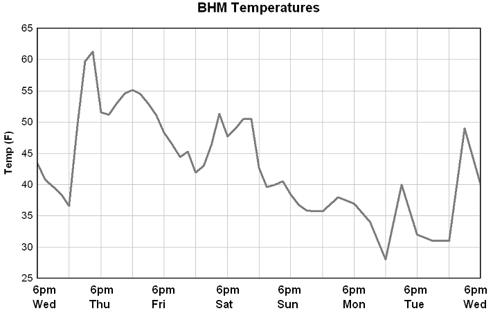
The bottom line is that rain now appears to be a possibility during the game Saturday (40% chance), with temperatures near 50. I don’t think we’re talking about weather like the 2000 game, when it was in the upper 30s with sleet and rain. It will turn colder on Sunday, with highs only in the low 40s and wind chills in the 20s at times. The GFS indicates that, with lingering moisture and the upper-level low nearby, we could see some light sleet or snow Sunday or Sunday night, but the NOGAPS doesn’t show this, and the Canadian only shows a little light precip Monday night. It will stay cold into next week.
The thing is…in dynamic weather systems, when cold air is moving into an area, that tends to suppress precip. It takes a lot of moisture or a strong upper-level disturbance to overcome that. So, a significant snow appears unlikely right now, at least through early next week. Snow showers on Sunday or Monday are possible, but I wouldn’t think they would amount to too much now. But, as you know, things can change!
Check out the surface temperature chart from the 12Z GFS model.
Category: Uncategorized


