Gravity wave in Texas, Fay
Weatherbrains listener David Reimer from Texas sent in a question about a very interesting feature…out ahead of an area of storms in Texas early this morning. He wondered if it is an outflow boundary or a gravity wave. The answer is: both!
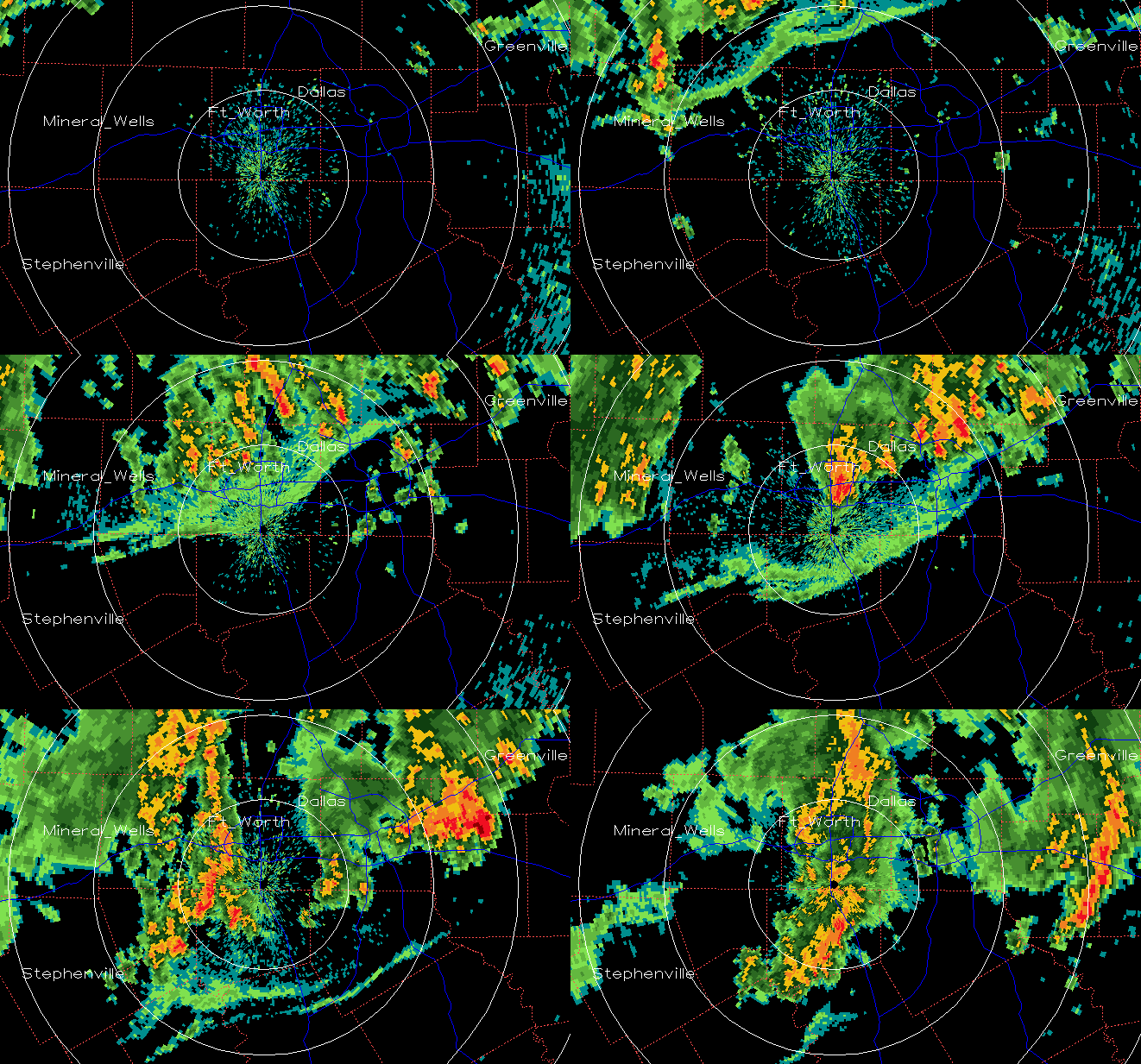
Here is a radar loop from Dallas, lasting from 1230 am to 500 am. Initially, there is one fine line out ahead of the storms, indicating the cool air rushing out of the storms and lifting up bugs, and maybe creating some clouds. Right around the time the fine line gets to the Dallas/Fort Worth metro, a second line forms. This often happens at night when cold air outflows from storms push into stable air…it creates a gravity wave.
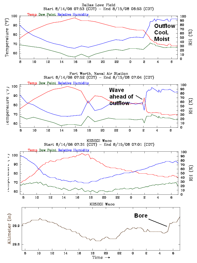
Looking at surface observations, when the boundary passes Dallas Love Field, it is fairly typical of a thunderstorm outflow, with a temperature drop and dewpoint rise. Once it gets to Fort Worth Naval Air Station, there is a warming and drying before the cooling and moistening. Waves at night often mix up the inversion, bringing warmer, dryer air down from just above the ground. By the time the boundary reaches Waco, the pressure pattern of a classic bore may be appearing, with a rapid pressure jump.
Fascinating stuff.
By the way, there is a lot of unvertainty with 92L this morning, with some models taking it into south FL, some up the Atlantic Coast, and some even into the Gulf. This thing hasn’t even developed yet, and if it stays over the islands around Hispaniola and Cuba too long, it will be slow to develop. If it develops and heads for the Gulf Coast north of Tampa, or the Atlantic Coast from Wilmington to Jacksonville, we at UAH are planning to take our new portable radar (MAX- Mobile Alabama X-band radar), along with the MIPS wind profiling system to the hurricane. More on that later.
Category: Uncategorized


