2010 to start bitterly cold in Alabama
**SEVERE COLD POSSIBLE NEXT WEEK**
A cold front will move through Alabama on New Year’s Eve, bringing cold northerly winds to the state by New Year’s Day. Temperatures will fall into the mid 30s, and then struggle to reach 40 even in the daytime over the weekend with north winds producing wind chills in the 20s.
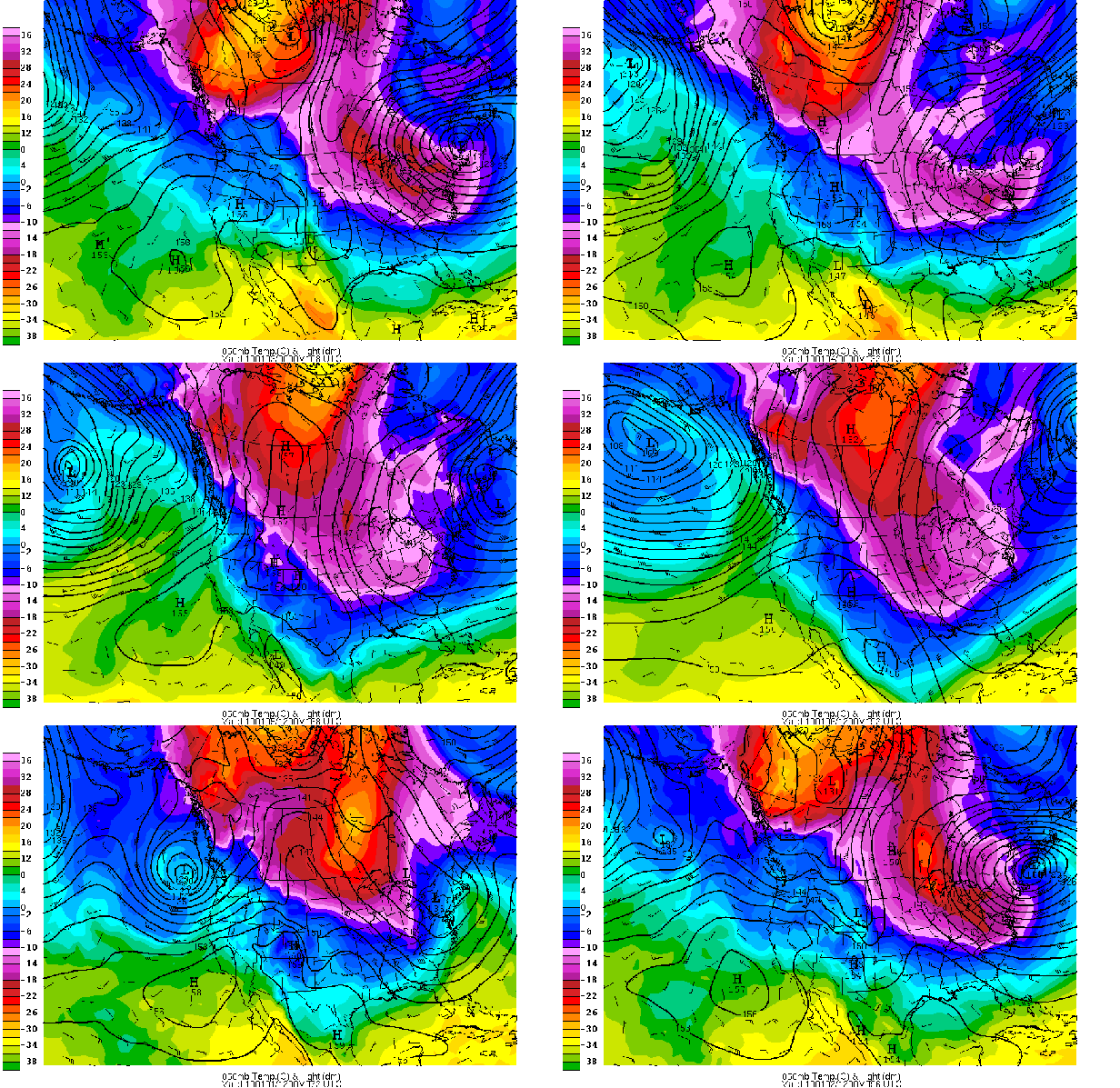
But, that’s only the beginning. All 4 major computer models (the GFS, Canadian, European, and NOGAPS) agree that a large upper-level low will form and cut-off over the Midwest or Northeast US next week, keeping a steady parade of cold fronts reinforcing the cold air over Alabama, and making it even colder (forecast below). This whole process, on the large scale, is related to the negative Arctic Oscillation we have been in for much of December, and it looks like we will stay in going into January.
The AO (Arctic Oscillation) has been thrown around a lot this year, so I’ll try to explain it a little bit. Basically, the AO is negative when surface pressures over the Arctic are above normal and pressures over mid-latitudes are below normal, allowing Arctic air to more readily push southward into North America and Europe, but leaving places like Greenland warmer than normal. The AO is positive when pressures are lower in the Arctic, not as conducive to the flow of cold air south.
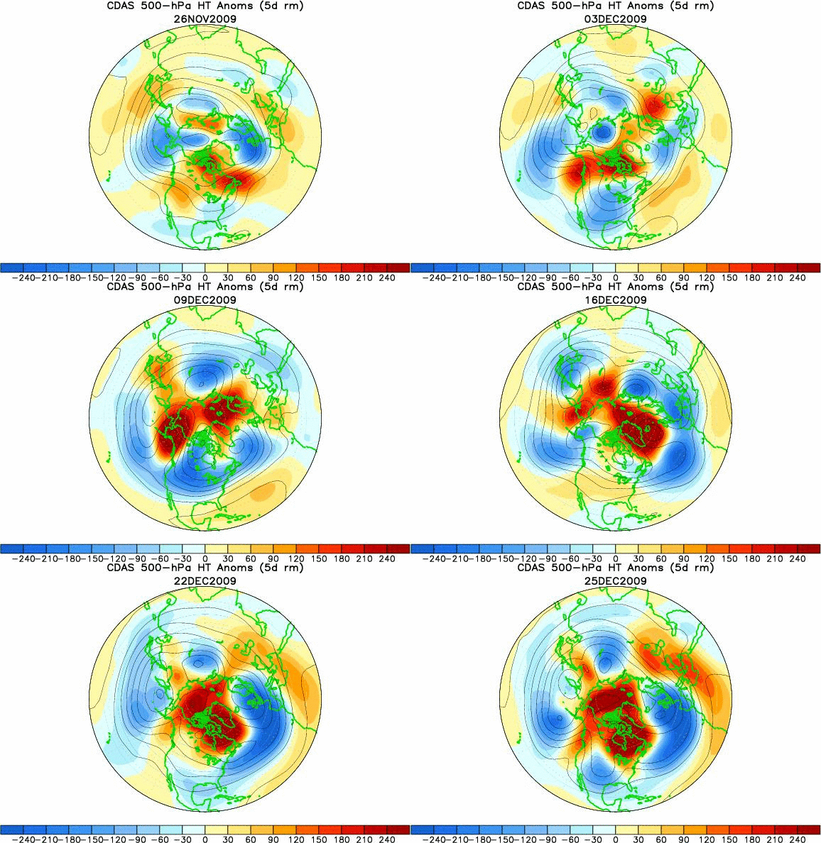
The height of the 500 mb pressure surface, and its deviation from normal, is a good indicator of abnormally warm and cold areas, especially in the winter. Take a look at a loop of 500 mb heights and departures from normal over the Northern Hemisphere for the past 30 days. Notice the warmer than normal air moving around places like Alaska, Greenland, and Hudson Bay, with colder than normal air farther south in the USA and Europe, as the cold Arctic air moves south.
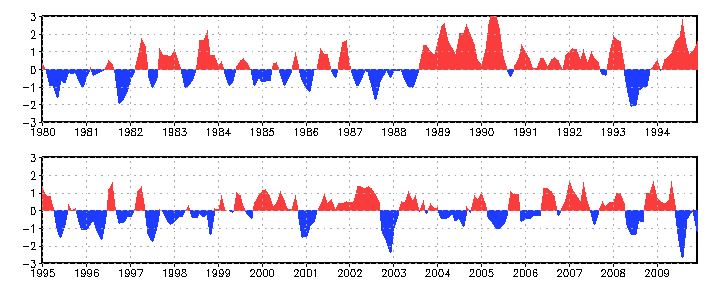
The AO oscillates between positive and negative, of course, but there have only been a few times since 1980 when the AO has been this low over a 3-month period.
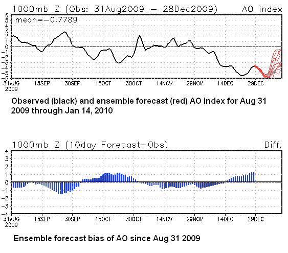
The low AO in mid-December was accompanied by things like a rare snowstorm from Houston into Louisiana and Misssippi on Dec 4, with a dusting of snow in Alabama on December 5. Also, extreme cold moved into much of Europe. Take a look at the AO since Aug 31, and its forecast through mid January. Ensemble models indicate it’s going very negative again. Also notice that the models have had a positive bias on the AO, so it may be even worse than anticipated by ensembles.
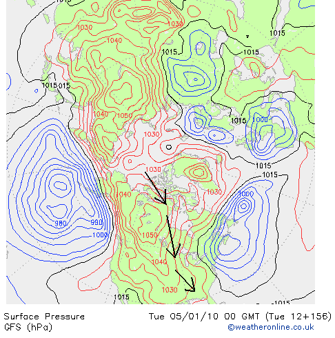
So, back to the forecast. With a blocking warm anomaly over Greenland, the models are in good agreement on the large upper low mentioned earlier, keeping cold northerly winds blowing from the Arctic, where there has been little to no sun now for weeks, into Alabama. Take a look at the GFS forecast surface map for next Monday evening. Our air is coming from the Arctic Ocean.
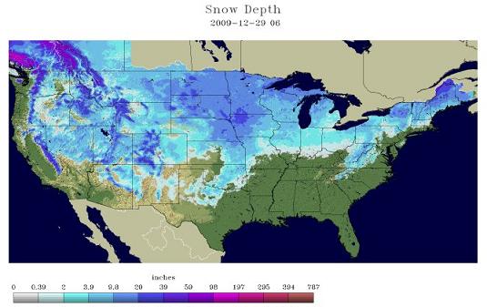
And, with a dense snow pack over the northern US, the air won’t have a chance to modify much on its way here.
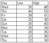
The models have been fairly consistent, between each other and from one run to the next. Here is a 9-day forecast of high and low temperatures for BHM, based mainly on raw surface temperature forecasts from the GFS, European, and Canadian models. I used the 00Z and 12Z runs, and weighted the averages 30/70. Cold.
Note the highs only in the mid 30s next week, with lows in the lower to mid 20s. This kind of weather can burst pipes, so prepare for that. Also think about how to keep your pets warm, and check on the elderly starting this weekend and be sure they have an adequate, safe source of warmth. The GFS model for the following week (really getting out there) indicates that it will get even colder…with single digits possible in Alabama. But, that’s a long way off.
I know people are wondering about snow. We could see a few snow flurries on New Year’s Day, and the Canadian model indicates a snow storm for central Alabama around the middle of next week. But, the GFS and European models indicate that the cold air will push the storm track out into the Gulf, keeping snow near to the coast. With the El Nino cycle in place also, we’ll have to watch that.
Category: Uncategorized



Comments (33)
Trackback URL | Comments RSS Feed
Sites That Link to this Post