Alabama 811 | Know What's Below.

Blog Archives

New Model Data

New Model Data

| February 10, 2014 @ 8:29 am

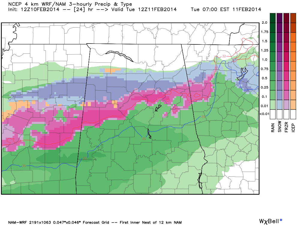
The 12Z high resolution NAM is in… and it confirms the threat of freezing rain and some snow across North/Central Alabama late tonight and tomorrow morning. This is the output valid at 6:00 a.m. Scroll down for the complete morning discussion. Mostly ice for the I-20 corridor, mostly snow for the U.S. 278 corridor.

Read More

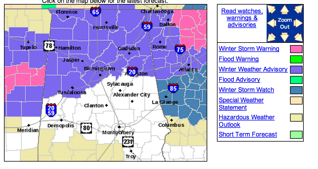
Winter Weather Advisory For North Alabama

Winter Weather Advisory For North Alabama

| February 10, 2014 @ 6:16 am

An all new edition of the ABC 33/40 Weather Xtreme video is available in the player on the right sidebar of the blog. You can subscribe to the Weather Xtreme video on iTunes by clicking here. MESSY WINTER WEATHER PATTERN: We will have two waves of precipitation across the Deep South this week, as a […]

Read More

Quick Update

Quick Update

| February 9, 2014 @ 3:04 pm

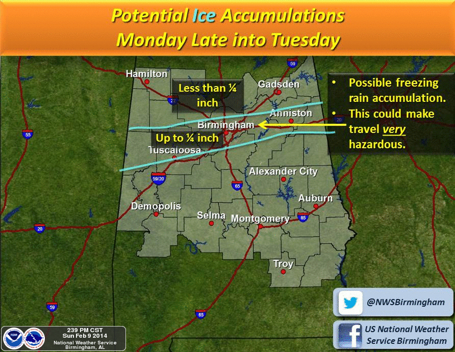
Not much change in the overall thinking. A significant winter storm will impact North Alabama late tomorrow night into Tuesday morning. The main threat for the I-20 cities (Birmingham, Tuscaloosa, Anniston) is from ice accumulation due to a wintry mix of freezing rain, sleet, and some snow. The greater snow totals will be around the […]

Read More

Winter Storm Threat For North Alabama

Winter Storm Threat For North Alabama

| February 9, 2014 @ 6:16 am

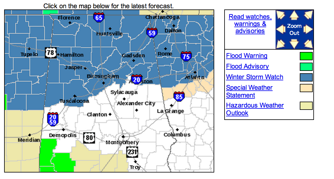
Brian will be along in a bit with the regular Sunday morning discussion and Weather Xtreme video. This is a look at the winter storm potential for Alabama tomorrow night into Tuesday morning. A Winter Storm Watch is in effect for areas generally along and north of I-20. The watch includes Tuscaloosa, Birmingham, Anniston, and […]

Read More

Winter Weather Advisory – Far North Alabama

Winter Weather Advisory – Far North Alabama

| December 9, 2013 @ 2:46 pm

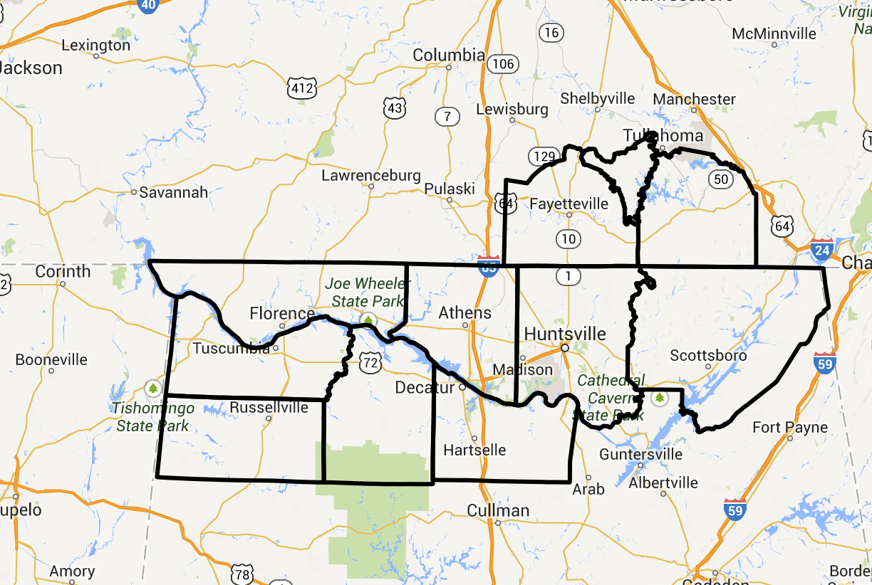
NWS Huntsville issues a “winter weather advisory” for 8 North Alabama counties for potential for a little light freezing rain or snow from midnight to 9 a.m. Not expected to be a major event, but a little bridge icing is possible in this part of far North Alabama. No problems expected to the south. New […]

Read More

Warmer, Then Colder; Occasional Rain

Warmer, Then Colder; Occasional Rain

| December 3, 2013 @ 3:52 pm

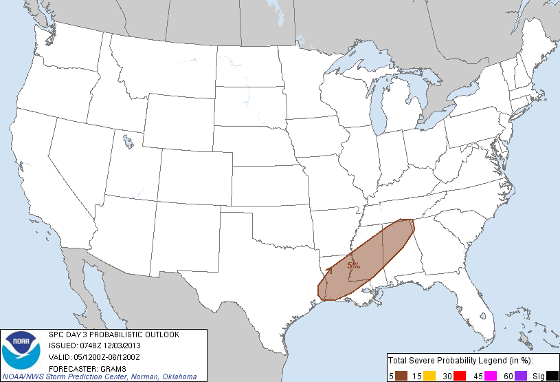
An all new edition of the ABC 33/40 Weather Xtreme video is available in the player on the right sidebar of the blog. You can subscribe to the Weather Xtreme video on iTunes by clicking here. WEATHER SMORGASBORD: Over the next seven days, parts of our state will have spring-like warmth, brutal Arctic cold, heavy […]

Read More

Interesting Forecast Challenges Ahead

Interesting Forecast Challenges Ahead

| December 1, 2013 @ 8:40 pm

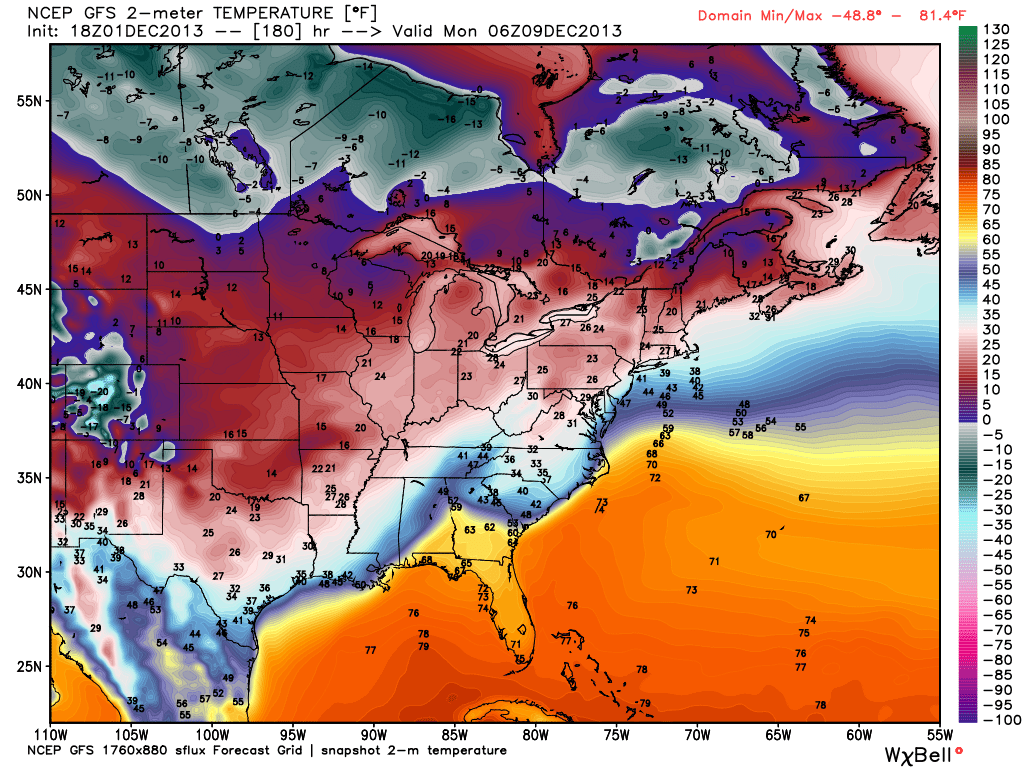
Our weather around here will be pretty interesting in the 7-10 day time frame. Bitterly cold air will invade the western and northern U.S. in coming days, with temperatures as in the -30s over parts of Montana and North Dakota. Many record lows, most likely, will be established. The leading edge of the cold air […]

Read More

A Look At The Alabama Weather Situation

A Look At The Alabama Weather Situation

| January 24, 2013 @ 9:09 pm

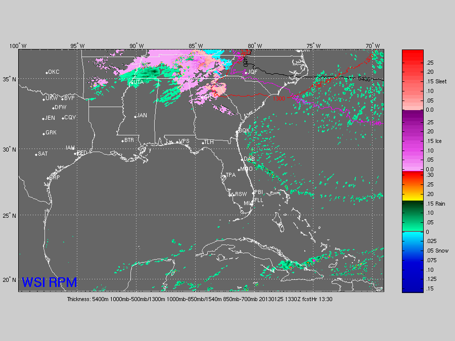
Things are fairly quiet across the great state of Alabama tonight. All reporting stations are well above freezing; Coldest spot is Decatur at 36… Birmingham reports 49. Colder air will continue to advect into North Alabama overnight, and there is still some potential for a period of freezing rain early tomorrow morning. Below is the […]

Read More

A Closer Look At Friday Morning

A Closer Look At Friday Morning

| January 22, 2013 @ 6:02 pm

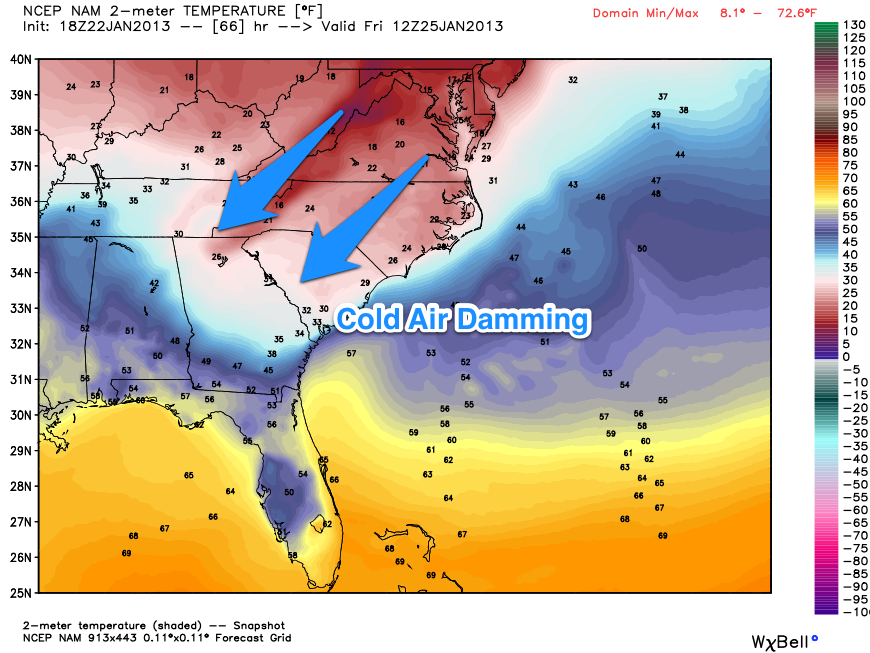
It will be a close call for freezing rain for Northeast Alabama to start the day Friday. Global models don’t really have the grid resolution to handle shallow layers of cold air, so the MOS products from the GFS and NAM really won’t reflect the surface temperatures very well in this case, most likely. A […]

Read More

Thirty Years Ago Today…

Thirty Years Ago Today…

| January 12, 2012 @ 7:00 am

A powerful cold front moved through Alabama on Saturday, January 9, 1982, sending temperatures plummeting. The high on Saturday at Birmingham was 49, but it was down to 27 by midnight and the mercury was in a free fall like I had never seen. It was bitterly cold all day on Sunday the 10th, with […]

Read More

Frozen Photographer

Frozen Photographer

| January 4, 2012 @ 11:56 am

Skip Baumhower is a professional photographer in Tuscaloosa that has sent us some amazing images over the years. Guess ole Skip stayed out in the cold too long last night…

Read More

Fun With Ice

Fun With Ice

| January 3, 2012 @ 11:26 am

Thanks to Skip Baumhower from Tuscaloosa for these images… he had a little fun with water on a cold winter morning in Alabama…

Read More

Ice/Snow Event In Pictures

Ice/Snow Event In Pictures

| February 4, 2011 @ 11:21 am | 2 Replies

All of these were sent in to us yesterday and last night from across the vast fruited plain of Alabama….

Read More

Warm-Up On Schedule

Warm-Up On Schedule

| February 3, 2011 @ 9:53 pm | 1 Reply

So far our projected warm-up is working nicely… Anniston hit 33 at 8:00, and Birmingham hit 33 at 9:00. Other communities along the I-20/59 corridor should be above freezing by midnight, and just a cold rain is likely for Tuscaloosa, Birmingham, Anniston, and Gadsden early tomorrow. However… freezing rain is still possible for much of […]

Read More