Blog Archives

Updated Snow Accumulation Projection

Updated Snow Accumulation Projection

| January 8, 2011 @ 9:13 am | 103 Replies

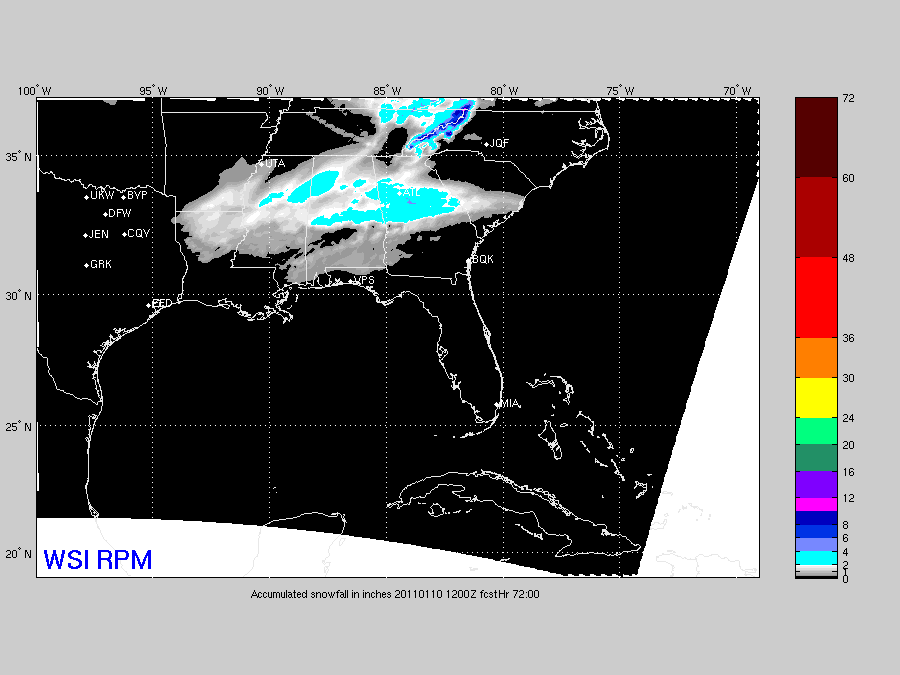
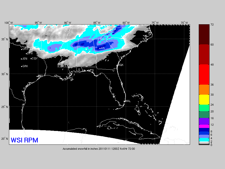
Here is a look at the 12Z snow accumulation output from the RPM model… We have to respect this model’s performance with the winter weather events this season (it has done very well), and it shows the snow maximum of 4-8 inches north of I-20, with lighter amounts to the south. We note the 09Z […]

Read More

Another One For You

Another One For You

| January 7, 2011 @ 8:50 pm | 8 Replies

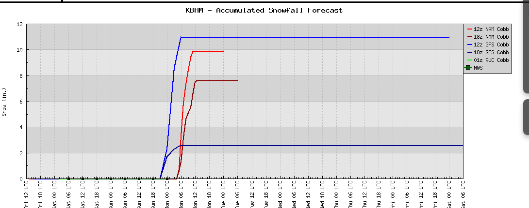
See this meteogram for Birmingham… snow accumulation from model output. Note that we have three model runs 7 to 11 inches here. Again, this is NOT a forecast, but something we must consider as we get closer to the event. The new 00Z NAM is suggesting around 10 inches for Birmingham as well.

Read More

Friday Night Notes

Friday Night Notes

| January 7, 2011 @ 8:29 pm | 35 Replies

Just some random information as things have finally gone somewhat calm for a bit…. *Deep down inside, the anticipation of snow brings back the excitement I remember as a child. I saw my first snow flakes at the old Normandale Mall in Montgomery when I was in first grade (I was living in Greenville at […]

Read More

Model Update

Model Update

| January 7, 2011 @ 5:54 pm | 86 Replies

A quick peek at the output of the new 18Z NAM shows heavy snow for North-Central Alabama… suggest 6-10 inches of snow around here. We are NOT that aggressive with our forecast, which I posted below the NAM output…

Read More

Snow/Ice Threat Sunday/Monday

Snow/Ice Threat Sunday/Monday

| January 7, 2011 @ 2:55 pm | 76 Replies

An all new edition of the ABC 33/40 Weather Xtreme video is available in the player on the right sidebar of the blog. You can subscribe to the Weather Xtreme video on iTunes by clicking here. Be sure and watch the Weather Xtreme video for all of the graphics that go along with this discussion… […]

Read More

Accumulation Potential

Accumulation Potential

| January 7, 2011 @ 1:56 pm | 45 Replies

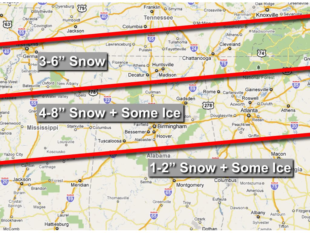
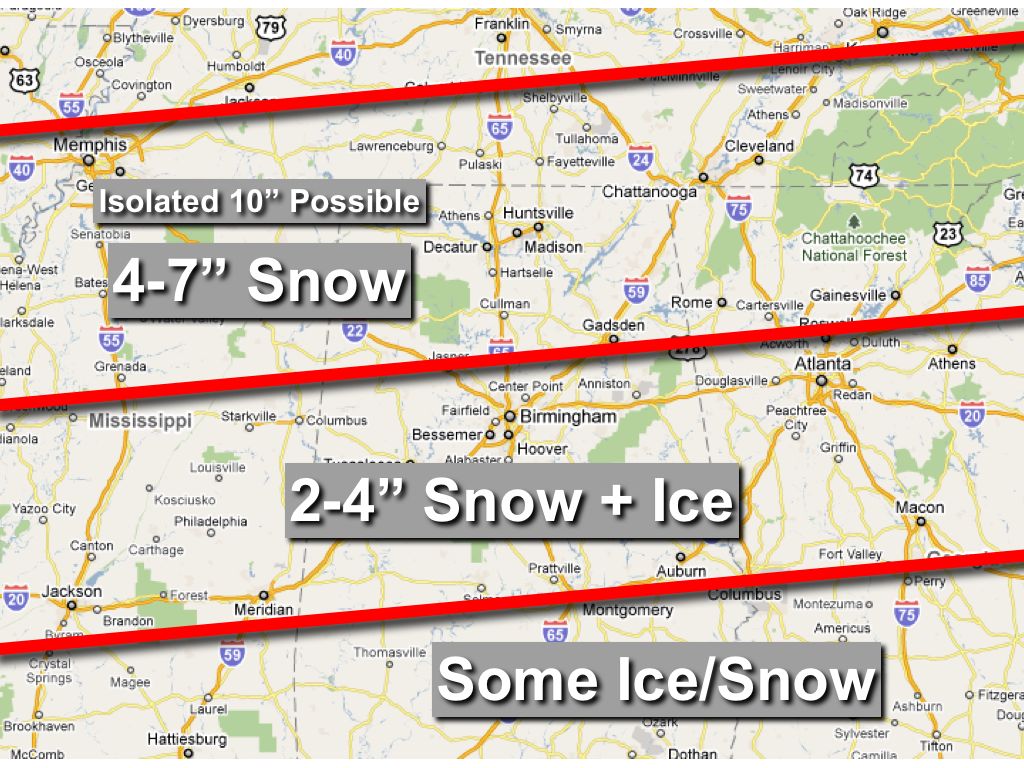
Will have the full discussion and video posted by 3:00, but here is a look at the new snow accumulation graphic we will use this afternoon… *Main impact of the winter storm will be from 12:00 noon Sunday through 12:00 noon Monday, with the heaviest snow and other winter precipitation Sunday night into Monday morning.

Read More

Peek At New Model Output

Peek At New Model Output

| January 7, 2011 @ 9:37 am | 41 Replies

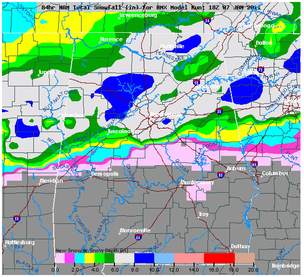
This is the snow accumulation through Monday morning at 6:00 a.m. CST from the 12Z run of the RPM… This suggests some light snow accumulation all the way down to Mobile and Dothan. Now… see the accumulated snow from the 12Z NAM. This will knock your socks off… More details coming soon…

Read More

Major Winter Storm Ahead

Major Winter Storm Ahead

| January 7, 2011 @ 6:30 am | 53 Replies

An all new edition of the ABC 33/40 Weather Xtreme video is available in the player on the right sidebar of the blog. You can subscribe to the Weather Xtreme video on iTunes by clicking here. Up front, just a reminder this event is still about 48 hours from beginning, so this forecast could (and […]

Read More

Major Winter Storm Potential Sunday/Monday

Major Winter Storm Potential Sunday/Monday

| January 6, 2011 @ 3:35 pm | 76 Replies

An all new edition of the ABC 33/40 Weather Xtreme video is available in the player on the right sidebar of the blog. You can subscribe to the Weather Xtreme video on iTunes by clicking here. BLOG: Let me apologize for the blog issues today… we are going to a distributed platform so you won’t […]

Read More