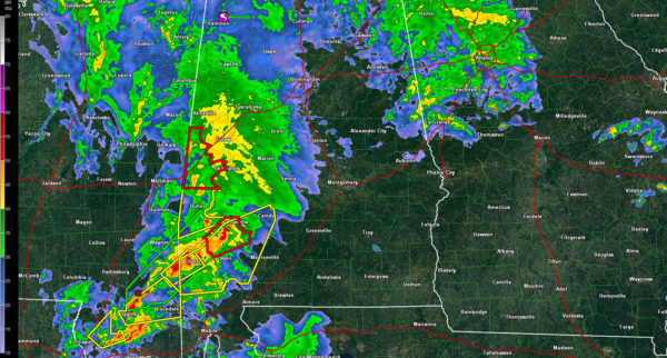
Radar Update at 6:45 p.m.
A large area of moderate to heavy rain is lifting northward across West Central Alabama at this hour. It extends across Pickens, Greene, Hale, Sumter Marengo and Choctaw Counties.
A tornado warning is in effect for parts of Sumter County. The most dangerous part of the storm is approaching Livingston.
South of there, intense storms are across Washington, Clarke and Mobile Counties. Several tornado and severe thunderstorm warnings are in effect for those storms. Areas from Chatom to Grove Hill to Camden to Monroeville to Mobile are being impacted.
A curved band of moderate to occasionally heavy rain extends across the Tennessee Valley down over East Central Alabama.
A small tornado touched down in Marion County 6 miles WSW of Hackleburg about 6:03 p.m. There was damage to the roof of a home. trees and power lines down. Dual-pol tornado debris signature detected from the Columbus MS NEXRAD. updated location and information.
A tornado watch remains in effect until midnight for much of Central Alabama, generally south of I-20.
Category: Alabama's Weather, Severe Weather


