Severe Weather Threat Tonight
**No afternoon Weather Xtreme video today**
Here are some quick notes on what to expect tonight…
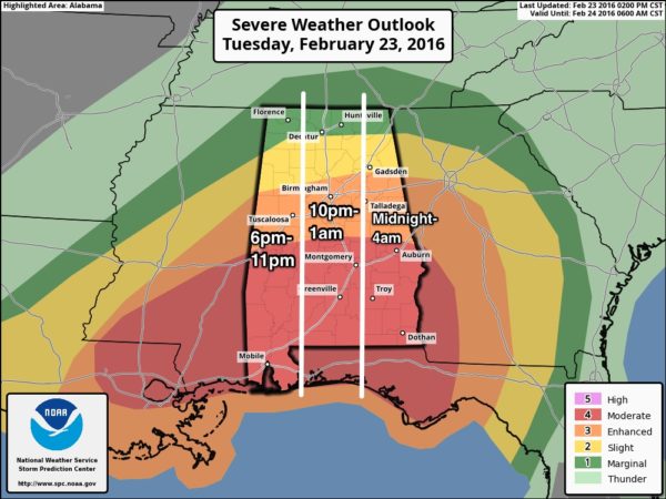
*The window for severe storms will open in West Alabama around 6:00 (near the Mississippi border), with the threat moving eastward through the night.
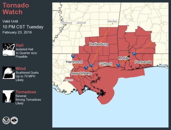
*A “PDS” tornado watch (particularly dangerous situation) is in effect for Southwest Alabama through 10:00 p.m.
It is likely other watches will be needed tonight up into Central, and perhaps North Alabama.
*A few strong/violent, long track tornadoes are possible tonight across South Alabama, in the “moderate risk” area as defined by the Storm Prediction Center. In fact, the guys at SPC have indicated they might upgrade a small part of South Alabama to a rare “high risk” this evening.
*Tornadoes are possible as far north as I-20 tonight (Tuscaloosa to Birmingham to Anniston). The chance of a tornado north of I-20 tonight is small, but not zero.
*Large areas of rain are moving across Mississippi and Alabama; sometimes this can mitigate a severe weather threat by making the air more unstable, but surface based CAPE values are over 500 j/kg over much of Alabama already, and the intense dynamic forcing from this weather system will keep the severe weather threat significant despite the rain.
*A flash flood watch remains in effect for much of Central Alabama; additional rain amounts of at least one inch could produce some flooding issues.
*Pressure gradient winds, not related to thunderstorms, could gust to 35/40 mph tonight, and that in itself could bring down a few trees and power lines due to the soggy soil conditions.
*See this blog post on getting ready for severe weather, including information about apps.
Brian Peters is live in West-Central Alabama in the Benchmark Jeep Storm Chaser… you can watch his live stream here…
TOMORROW: Temperatures fall through the 40s with periods of light rain. A few flurries are possible near the Tennessee border tomorrow night, but with no impact.
The sky becomes partly sunny Thursday.
FRIDAY THROUGH THE WEEKEND: Sunny days, clear nights, and a warming trend. We should be well up in the 60s by Sunday afternoon.
Some rain will return early next week thanks to an approaching cold front Monday.
Stay tuned to the blog tonight for frequent updates…
Category: Alabama's Weather


