Low Pressure System Strengthening
The low pressure system has moved into northern Louisiana now and is strengthening.
Here is a raw surface chart.
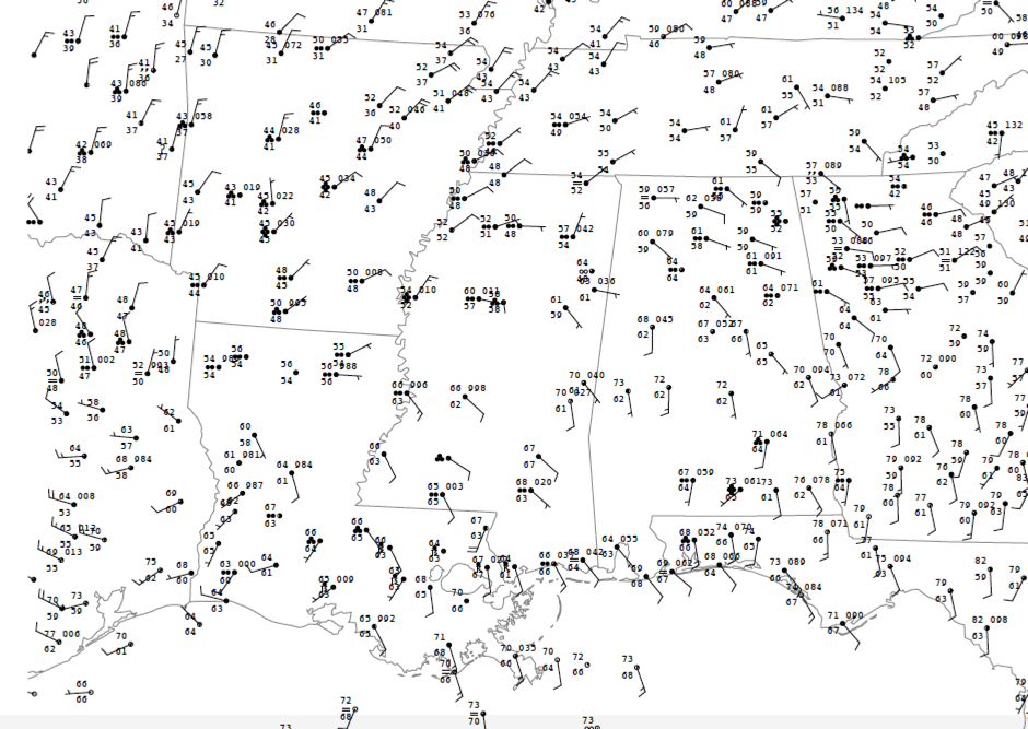
You can see the swirl in the wind barbs over eastern Texas and western Louisiana. The value in the top right quadrant of each of the station obs is the barometric pressure. It shows the last two digits and the tenths. So the 981 you see there is 998.1mb at Fort Polk. There has been a subsequent readings since then that shows 29.45 inches or 997.3 mb. So the minimum pressure in the low is probably under 997 mb now.
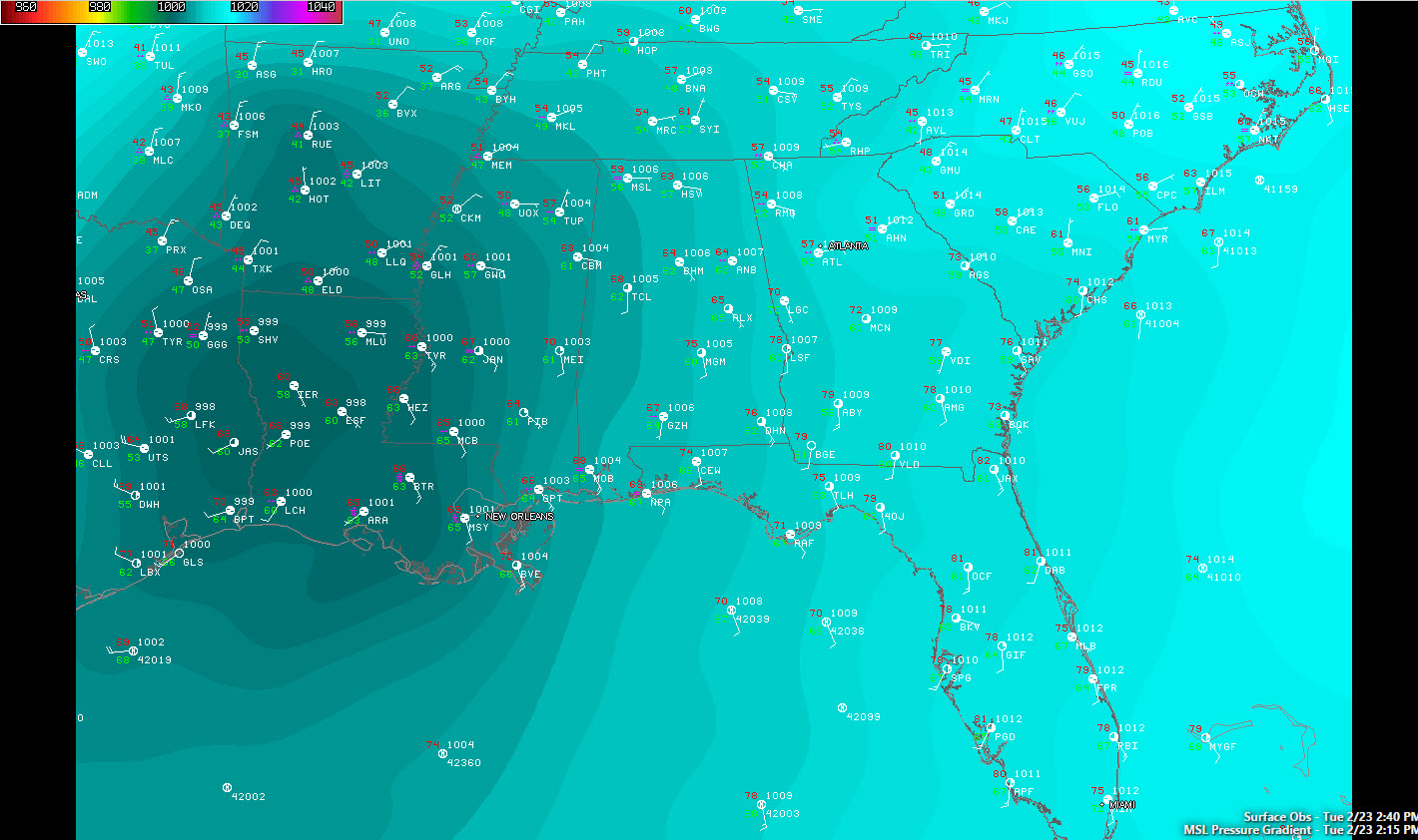
Here is a more graphical look at the pressures:
Winds will continue to increase ahead of the low, both at the surface an din the lowr levels of the atmosphere. Aloft, a strong jet stream maximu will be nosing into the area as well. Instabilities have been increasing over Central and South Alabama as well. They are now over 1,000 joules/kg over areas south of I-20.
This is a very dangerous severe weather situation tonight, not only for South Alabama, but for Central and North Alabama as well. Spann. Will be along with an updated video and analysis shortly. I will have frequent updates throughout the afternoon and night. Stay tuned.
Category: Alabama's Weather, Severe Weather
About the Author (Author Profile)
Bill Murray is the President of The Weather Factory. He is the site's official weather historian and a weekend forecaster. He also anchors the site's severe weather coverage. Bill Murray is the proud holder of National Weather Association Digital Seal #0001 @wxhistorianSubscribe
If you enjoyed this article, subscribe to receive more just like it.


