PDS Tornado Watch Issued; High Risk Possible for South Alabama Soon
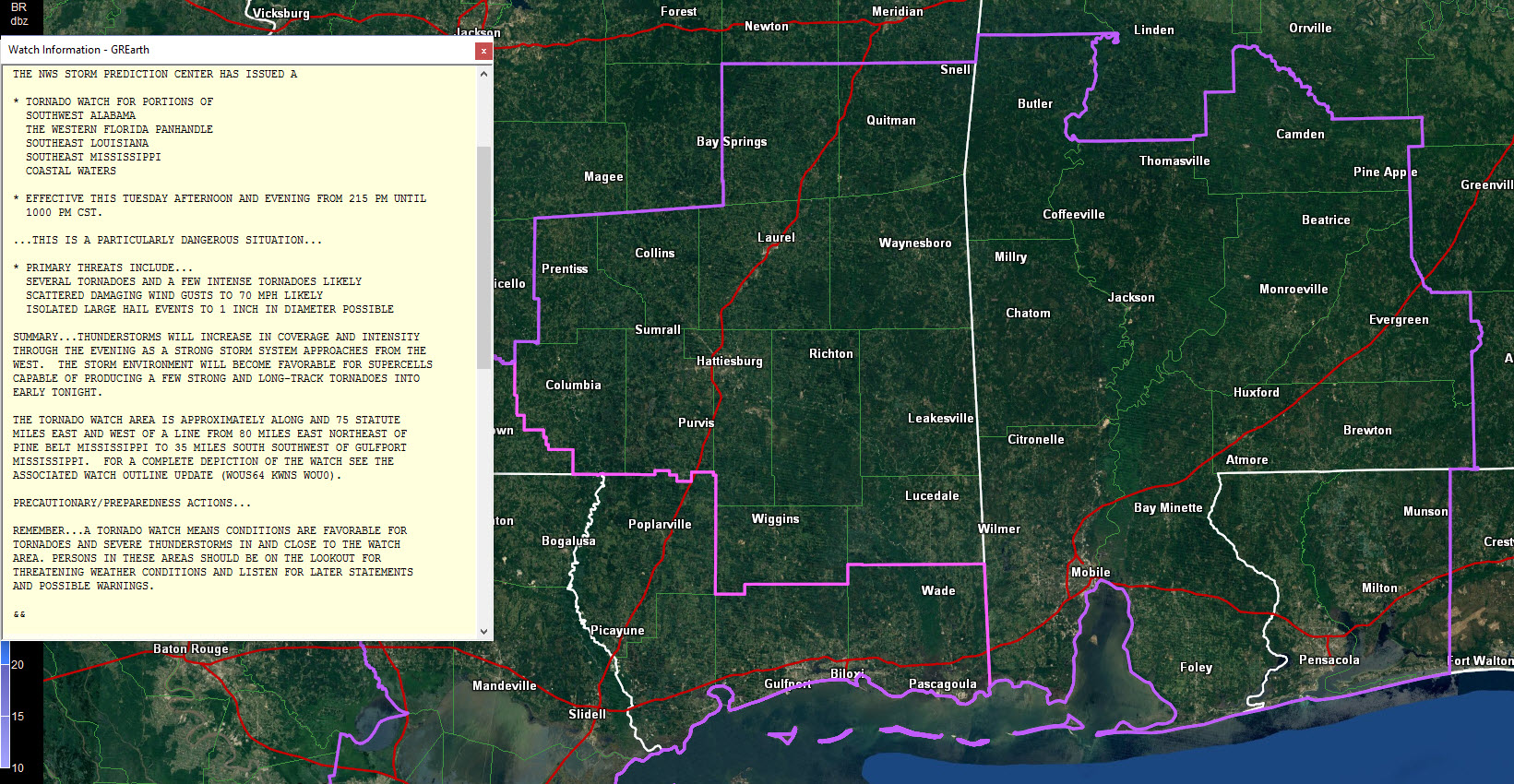
The tornado watch has just been issued for extreme Northwest Florida southern Mississippi and Southwest Alabama. No counties from the NWS Birmingham County Warning Area are in the watch…yet.
The watch is a PDS watch, which is means it is a Particularly Dangerous Situation for the threat of significant, long track tornadoes.
Alabama counties include: Baldwin, Choctaw, Clarke, Conecuh, Escambia, Mobile, Monroe, Washington and Wilcox. It goes till 10:00 PM CST
A second tornado watch was issued back over southeastern Louisiana
The new SPC outlook is out, and is basically unchanged. But the forecasters did note the following: HOWEVER…DETAILS CONCERNING THE EVOLUTION OF WARM SECTOR STORMS REMAIN UNCLEAR BUT AN UPGRADE TO HIGH RISK MAY BE WARRANTED AT A LATER OUTLOOK UPDATE FOR A SMALL PORTION OF THE MODERATE RISK /I.E. SRN AL/.
Our 1000 mb surface low is located near Jasper Texas at this hour, southeast of Lufkin.
Winds are starting to pick up over Southwest and South Central Alabama. At Montgomery, they are averaging 13 mph and gusting to 18 mph. At Evergreen, there are averaging 21 mph, gusting to 29 mph. Winds just gusted to 37 mph in Reserve LA. Winds will continue to increase during the afternoon and especially this evening over Central Alabama. Wind advisories are in effect.
Our warm front is scooting northward now ahead of those increasing surface winds. It extends from the low to north of Alexandria to north of Vicksburg and Jackson, to near Columbus MS to near Jasper and back around to near Jacksonville AL. The sun is peeking through the clouds from Brent to Clanton to Prattville and Auburn. Temperatures are in the lower 70s in the US-80 corridor from Demopolis to Selma to Montgomery and in the upper 70s over South Alabama! Dewpoints are in the middle 60s across South Alabama including 66F at Andalusia.
Instability values are already at 500 joules/kg south of the warm front with values over 1,000 j/kg south of the area from Butler to Marion to Clanton to Auburn. The airmass will continue to become more unstable through the afternoon.
There will be plenty of wind shear as well, especially as we go through the afternoon. Our low level surface winds are out of the southeast, but quickly turn around to the southwest as you go up with height. This turning is very indicative of tornado potential. There is already 130 m2/s2 of low level (0-1km) helicity according to the Birmingham special balloon release at noon. There is already sufficient speed shear as well for rotating storms. This will only increase as we go into the evening hours.
Storms over Southwest Alabama will lift into West Central Alabama by 5-6 p.m. CST this afternoon. Those storms could be severe. They will intensify rapidly between 6-8 p.m. as they lift northeast.
Category: Alabama's Weather, Severe Weather
About the Author (Author Profile)
Bill Murray is the President of The Weather Factory. He is the site's official weather historian and a weekend forecaster. He also anchors the site's severe weather coverage. Bill Murray is the proud holder of National Weather Association Digital Seal #0001 @wxhistorianSubscribe
If you enjoyed this article, subscribe to receive more just like it.


