Just Say No to BINOVC
You don’t see the BINOVC (Breaks in Overcast) remark in METAR surface observations much anymore. It indicates that there are breaks in the overcast.
While patches of blue sky may seem comforting on a dreary day, not when we see a severe weather threat. Breaks in the overcast mean warming sunshine that can make the atmosphere more unstable.
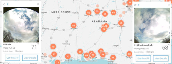
That is exactly what we are seeing across South Central Alabama at this hour. Looks at these views from BloomSky cameras at Hope Hull and Montgomery.
The values are temperatures reported by BloomSky owners.
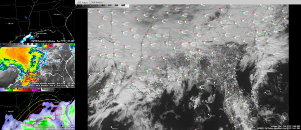
Here is the visible satellite image at this hour in the large panel with surface observations:
The top left panel shows lightning, which is mostly along the Louisiana coast now. Some lightning is starting to fire over southern Louisiana.
The middle left panel shows infrared satellite with the tornado watch outlines in red.
The lower left panel shows instability values increasing as far north as Central Alabama. The SPC Convective Outlook is overlaid on top of the CAPE values.
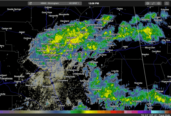
Showers have been lifting through the Birmingham Metro area for the past hour with brief heavy rain but no lightning yet. CAPE values are approaching 500 joules in the Birmingham area already. Here is the Birmingham radar.
TORNADO WAS REPORTED NEAR NEW ORLEANS
A tornado was reported in St. Charles Parish and in Jefferson Parish just southwest of New Orleans at 11:11. A funnel cloud was observed from the New Orleans International Airport.
TORNADO CROSSING THE INTERSTATE SOUTHEAST OF BATON ROUGE
The NWS Slidell just received a report that tornado was crossing I-10 near Prairieville. Walker and Livingston on I-12 are in the path. A tornado warning is in effect.
Category: Alabama's Weather


