Late Night Analysis
As we approach the witching hour tonight, the end is finally in sight.
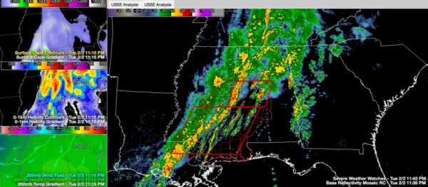
The line of thunderstorms over eastern Mississippi has intensified as our cold front start to surge eastward. The low level jet at 5,000 feet has intensified in the past few hours and it providing high levels of low level shear.
In addition, instabilities have spiked slightly, as temperatures aloft have decreased over the past couple of hours over West Alabama.
The line will reach Tuscaloosa/Jasper by 12:30, Cullman by 12:45, Birmingham by 1:30 and Gadsden by a little after two.
The threat of spin up tornadoes is high from Livingston to Fayette, especially where there are kinks in the line. Damaging winds are also possible.
To the east, heavy storms are moving into Shelby County. They are part of a line of showers and storms that extends from Wilcox and Dallas Counties into western Chilton, Shelby, Jefferson and Blount Counties. These storms are not severe at this time, but still could do so.
A tornado watch remains in effect until 4 a.m. for areas along and west of I-65 and along and south of I-20.
Category: Alabama's Weather, Severe Weather


