Into The 20s Late Tonight
COLD NIGHT AHEAD: Temperatures for many communities north of Birmingham are only in the upper 30s at mid-afternoon despite maximum sunshine. Once the sun goes down, temperatures will fall quickly and we project a low in the 22-26 degree range early tomorrow for most places. We might even hear of upper teens across the coldest valleys of North Alabama with a clear sky and light wind.
The weather stays cool and dry tomorrow and Thursday; we expect a high upper 40s tomorrow, and low 50s Wednesday. We should point out another freeze is likely early Wednesday morning, with mid to upper 20s likely.
NEXT RAIN: The sky becomes mostly cloudy Thursday, and a passing disturbance will bring some rain to the state late Thursday afternoon and Thursday night. The latest model data hints our main window for rain will come from about 4:00 p.m. Thursday until 4:00 a.m. Friday. The air will be stable, no severe weather, no thunder, and no flooding. Rain amounts should be under 1/2 inch.
Most of the day Friday will be dry, but mostly cloudy. And, the afternoon will be warmer with a high up in the low 60s.
THE ALABAMA WEEKEND: Saturday should be the warmest day out of the next seven… the GFS is printing 64 for Birmingham as the high. The sky will be mostly cloudy, but the chance of rain during the the day will be low. Then, more rain will likely develop Saturday night into Sunday as a surface low forms over Alabama and moves northeast. Again, rain totals shouldn’t be too heavy, and there certainly won’t be any issue with severe weather.
As the rain moves out Sunday, colder air moves in. In fact, temperatures could very well fall during the day Sunday, reaching the 40s by afternoon with a brisk north wind.
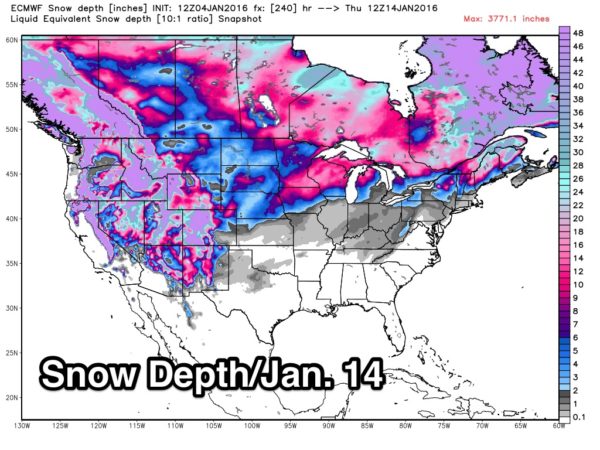
NEXT WEEK: The pattern favors cold air diving into the northern and eastern U.S. early in the week; I would not be surprised to see a day or two with highs in the 30s and lows in the teens by mid-week. And, the cold snap looks generally dry, although there could be a day with a few flurries over far North Alabama. For now global models show no threat of significant snow for Alabama through the next ten days.
See the Weather Xtreme video for maps, graphics, and more details.
FOOTBALL WEATHER: Saturday, Jacksonville State plays North Dakota State for the FCS National Championship Saturday in Frisco, Texas (north of Dallas; 11:00a CT kickoff). There will be cloudy periods during the game, and a passing shower is possible. About 48 degrees at kickoff, rising into the low 50s by the final whistle.
For Bama fans headed to Phoenix next week (Bama plays Clemson for the FBS National Championship Monday night January 11 at 7:30p CT)… for now the weather looks cool and dry; 50s during the day, falling into the 40s during the game.
WEATHER BRAINS: Don’t forget you can listen to our weekly 90 minute netcast anytime on the web, or on iTunes. This is the show all about weather featuring many familiar voices, including our meteorologists here at ABC 33/40. We will produce this week’s episode tonight at 8:30 CT… you can watch it here.
CONNECT: You can find me on all of the major social networks…
Facebook
Twitter
Google Plus
Instagram
Look for the next Weather Xtreme video here by 7:00 a.m. tomorrow….
Category: Alabama's Weather


