Chill Holds On
Central Alabama saw a mixture of clouds and sunshine yesterday, but the return to some sunshine did little to thwart the chill of the cold air advection with high temperatures across Central Alabama only climbing into the 40s.
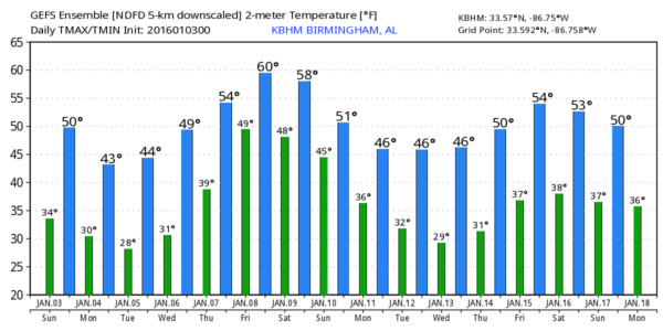
Fortunately, the clouds stuck around a little overnight, so that helped to temper the fall in temperatures with lows this morning in the 28 to 34 range across North and Central Alabama. Look for another day with a mixture of sun and clouds with highs climbing a little bit as we see them reach the upper 40s and lower 50s.
The upper trough across the eastern US stays in place until late Monday as a surface high centered over the Dakotas this morning gradually shifts eastward. The surface high will keep us in a northerly surface flow through Monday, but as it finally gets over Ohio on Tuesday, we will see the surface flow here switch around to the east. This along with the upper flow going southwesterly as the upper trough moves into the Atlantic will see a fairly rapid warmup at mid week as we go from highs in the 40s to highs in the lower 50s Wednesday and around 60 for Thursday.
Unfortunately the southwesterly flow aloft will also bring moisture to the Lower Mississippi River Valley. This together with the return of low level moisture on Wednesday and Thursday as the surface flow comes around to the south and southeast will also bring rain chances back to the area. Looks like the best chances for rain will come Thursday and Friday for Central Alabama. The GFS dries out the Southeast US on Saturday, but we’re likely to see clouds stick around with the upper flow remaining out of the southwest.
For those who might be headed for the beach, the conditions will improve after today as sunshine returns. But just like the weather in Central Alabama, temperatures will remain cool along the Gulf Coast with morning lows in the lower 40s and afternoon highs in the 50s. Rain chances go up Thursday and Friday.
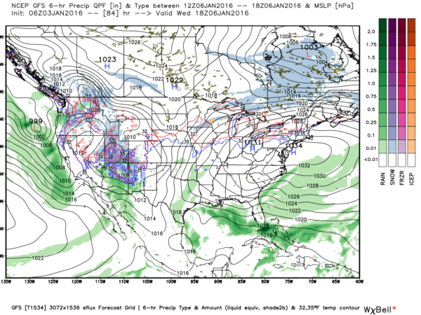
Looking into Week 2, the GFS is introducing a deep trough with its axis along and just west of the Mississippi River Valley. This could spell some of the coldest weather we’ve seen this winter along with some winter weather mischief for places in the Lower Mississippi River Valley. This is way too early to speculate since there is NO skill in forecasting this far out. It will be interesting to follow this feature to see how later model runs evolve. By January 15th, the upper flow has gone nearly zonal for the eastern half of the country. Another short wave could wring out some rain around the 16th/17th time frame but an upper ridge returns around the 18th to warm us up again.
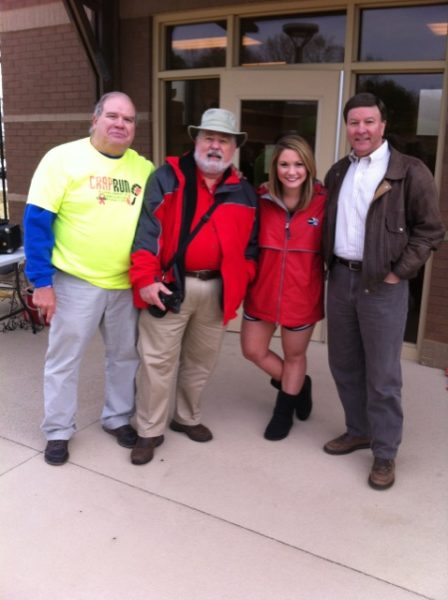
Meaghan Thomas and I enjoyed participating in the Mayor’s Polar Plunge yesterday morning at the sports complex in Piedmont. Nearly 100 folks braved the cold weather to come out and “plunge” into the pool to raise money for Venecia’s Foundation helping people fight their battle with cancer. Yes, Meaghan was crazy enough to “plunge” into the pool directly from the diving board. I volunteered to take pictures and record the event with video (smart). Here’s Meaghan and I with Keith Word, event emcee (left), and Congressional Representative Mike Rogers (right).
James Spann is expected back from his vacation with the next Weather Xtreme Video on Monday morning. Enjoy the day, stay warm, and Godspeed.
-Brian-
Category: Alabama's Weather


