Severe Storms Possible Sunday Night
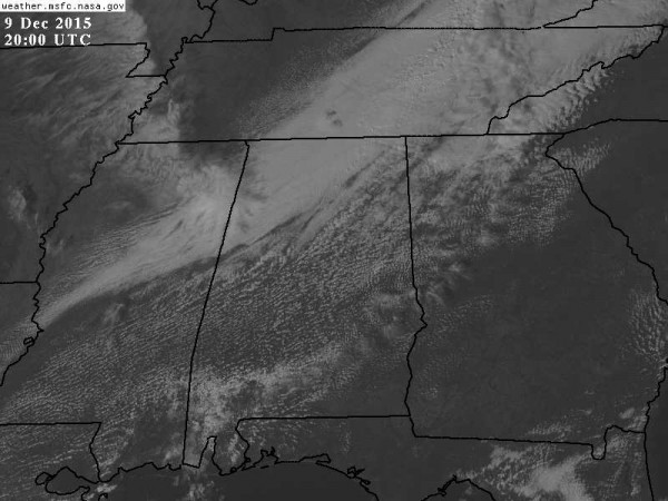
RADAR CHECK: Despite a short wave passing across North Alabama this afternoon, nothing is showing up on radar at mid-afternoon. Seems like the low levels are just too dry for any showers today. Temperatures are in the 50s over the northern third of the state, with 60s along I-20 (Birmingham, Tuscaloosa, Anniston).
TRENDING WARMER: Look for mild afternoons tomorrow through Saturday; we reach the upper 60s tomorrow, 70 degrees Friday, and low to mid 70s Saturday. In fact, the latest run of the GFS is printing a high of 75 for Birmingham Saturday, which is only three shy of the record for December 12, 78 degrees set in 1971.
Moisture levels will rise Friday and Saturday, and an isolated shower is not totally out of the question, but the chance of any one spot getting wet is very small, and we won’t mention it in our forecast for now. We will have intervals of sunshine through the clouds both days.
SEVERE WEATHER POTENTIAL SUNDAY NIGHT: SPC has most of Alabama in a severe weather risk on their Day Five outlook as a dynamic weather system will be approaching. Before the storms arrive, temperatures will rise up into the 70 to 75 degree range Sunday afternoon with a good south breeze of 10-20 mph.
A deep surface low will move from Arkansas to south of Chicago Sunday, with a trailing front supported by a deep upper trough to the west. Dewpoints will surge into the 60s ahead of the front Sunday afternoon, always a “red flag” in December.
Here is our latest thinking:
TIMING: While a shower could break out in a few spots Sunday afternoon, the main threat of organized storms will come from about 6:00 p.m. Sunday through 4:00 a.m. Monday.
THREATS: The low level jet (about 5,000 feet off the ground) will be in excess of 50 knots, and it won’t take much to get some of that down to the surface with the stronger thunderstorms. So, damaging straight line winds will be the main threat; the squall line will have potential to knock down trees and power lines.
Storm relative helicity values are high as well ahead of the surface front, meaning a few small, spin-up tornadoes will be possible within the line. These are typically short lived, and providing warnings is very difficult.
RAIN: Amounts of around one inch are likely, for now we don’t expect enough rain for flooding issues as the storms should be moving along at a pretty good pace.
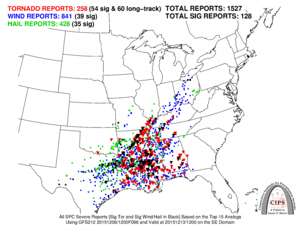
ANALOGS: If you take the top 15 events with similar synoptic weather conditions, and put the severe weather reports from all 15 of those events on a map, they would look like this…
So, needless to say we will need to pay close attention. Remember, we are still several days away from this event, and the forecast could change, so keep an eye on blog posts here. Of course, see the Weather Xtreme video for all the maps, graphics, and more details.
NEXT WEEK: Rain ends early Monday morning, and the sky should begin to clear Monday afternoon as a dry slot works into the state. The high will drop into the upper 50s. Tuesday and much of the day Wednesday will be rain-free; next chance of showers will come Wednesday night into Thursday with a cold front, but moisture will be limited, and severe weather/heavy rain is not expected this time.
FOOTBALL WEATHER: Jacksonville State will host Charleston Southern Friday night (7:00p CT kickoff) at Burgess Snow Field in the FCS quarterfinals; the sky will be mostly fair with temperatures falling from 68 at kickoff, into the low 60s by the final whistle. Very comfortable for December.
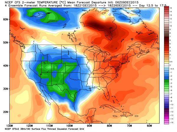
CHRISTMAS WEATHER: Still looks mild in the eastern U.S… cold in the west. Still way too early for a specific forecast.
AT THE BEACH: Expect mostly sunny mild days, and fair nights through Saturday from Panama City Beach over to Gulf Shores… showers and storms return late Sunday and Sunday night. See the complete Gulf Coast 7 Day Planner here. The Gulf Coast Beach Forecast is presented by Gulf Shores Plantation by Mandoki Hospitality Vacation Rentals. Escape to Gulf Shores Plantation where memories last a lifetime.
WEATHER BRAINS: Don’t forget you can listen to our weekly 90 minute netcast anytime on the web, or on iTunes. This is the show all about weather featuring many familiar voices, including our meteorologists here at ABC 33/40.
CONNECT: You can find me on all of the major social networks…
Facebook
Twitter
Google Plus
Instagram
Look for the next Weather Xtreme video here by 7:00 a.m. tomorrow…
Category: Alabama's Weather


