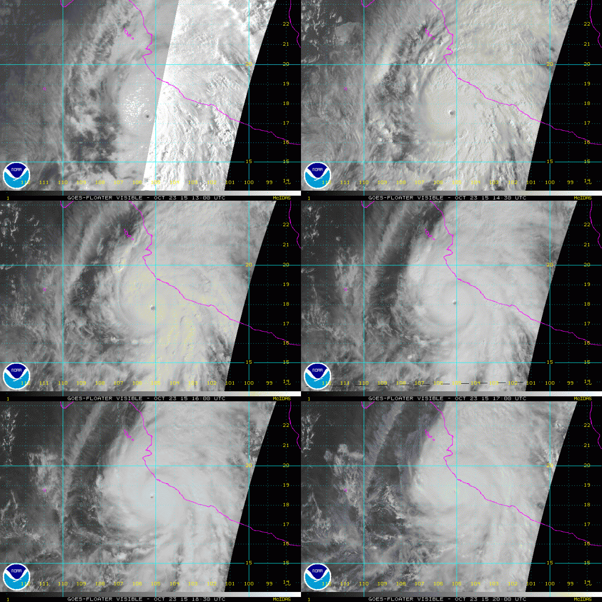
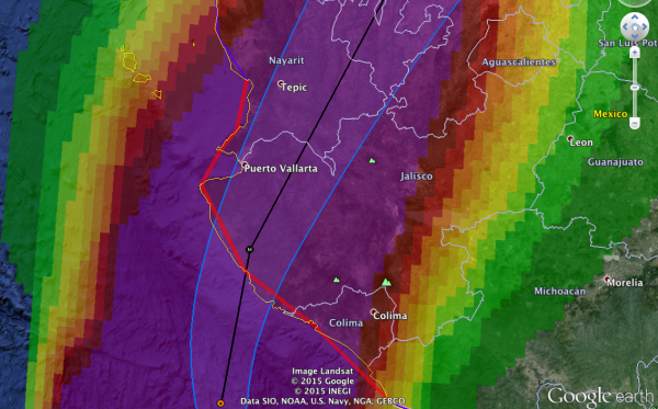
Eyes On Patricia
THIS AFTERNOON: It is a warm, dry day across the great state of Alabama with a mix of sun and clouds; temperatures are pretty close to 80 degrees in most spots. Nothing on radar around here.
OUR WEEKEND: Most of the action will be west of Alabama, where flooding potential will continue over the eastern half of Texas, Louisiana, and Arkansas. Around here we expect a mostly cloudy sky tomorrow and Sunday with a high close to 80 tomorrow, and in the mid to upper 70s Sunday. We will introduce the risk of widely scattered showers tomorrow, mainly over North and West Alabama, but nothing too widespread or heavy. Pretty much the same situation Sunday… a shower is possible, but the big, organized rain areas stays just to the west.
NEXT WEEK: The “ghost of Patricia” will be just south of the Louisiana coast Monday in the form of a tropical low. There is a chance it regenerates into a tropical depression, or even a tropical storm. But, the impact will be the same; rain and flooding will be the primary threat… it is not expected to become a hurricane over the Gulf due to cooler water and unfavorable upper air conditions.
Showers will begin to increase across Alabama Sunday night, and widespread rain is likely Monday and Tuesday. Rain amounts of at least 1 to 2 inches seem likely; some spots could get more. And, Tuesday will be a windy day with a tight pressure gradient between the low to the west, and a strong high to the east. South winds Tuesday will be in the 15-30 mph range, with higher gusts. While severe storms are not expected, the combination of the gradient wind Tuesday and heavy rain could be responsible for knocking down a few trees.
We will need to maintain the chance of rain on Wednesday, and some thunderstorms could be involved as well with a cold front moving in from the west. Then, cooler and drier air will arrive Thursday and Friday. See the Weather Xtreme video for maps, graphics, and more details.
PATRICIA: This historic hurricane in the eastern Pacific features a central pressure of 879 millibars, or 25.96″, and sustained winds of 200 mph. It will make landfall soon on the Mexican coast.
The hurricane will weaken quickly over Mexico tomorrow, but the remnant low will emerge over the far western Gulf of Mexico late in the weekend.
FOOTBALL WEATHER: Dry and pleasant weather for the high school games tonight; temperatures will fall through the 70s.
Alabama will host Tennessee at Bryant-Denny Stadium in Tuscaloosa tomorrow (2:30p CT kickoff). The sky will be mostly cloudy, and a brief shower, or a little light rain is possible during the game. Nothing heavy, nothing widespread. Temperatures will drop from near 80 at kickoff, into the mid 70s by the final whistle.
Auburn is on the road; they travel to Fayetteville to take on the Arkansas Razorbacks at 11:00a CT tomorrow. The day will be cloudy and wet; showers are likely during the game, but the good news is that now it looks like the heaviest rain could very well be south and east of Fayetteville at game time. Temperatures will be in the mid 60s.
RACE WEEKEND AT TALLADEGA: The sky will be mostly cloudy at the Talledega Superspeedway tomorrow and Sunday. I can’t rule out a brief shower, or a touch of light rain each day, but the most widespread rain should be well to the west of the track. Temperatures will peak in the upper 70s tomorrow, and mid to upper 70s Sunday.
WEATHER BRAINS: Don’t forget you can listen to our weekly 90 minute netcast anytime on the web, or on iTunes. This is the show all about weather featuring many familiar voices, including our meteorologists here at ABC 33/40.
CONNECT: You can find me on all of the major social networks…
Facebook
Twitter
Google Plus
Instagram
I had a great time today visiting with the 6th graders at Hanceville Middle School in Cullman County… be looking for them on the Pepsi KIDCAM today at 5:00 on ABC 33/40 News! My next Weather Xtreme video will be posted bright and early Monday morning by 7:00… Brian Peters will have the video updates tomorrow and Sunday. Enjoy the weekend!
Category: Alabama's Weather


