Temperature Rising
While there were a few more showers and thunderstorms yesterday than expected, the trend for hotter and drier weather still seems on track as both surface high pressure and an upper ridge work their way into the Southeast US over the next few days. The impact of this will be to push convection off to the west of Alabama and gradually raise temperatures with middle 90s possible into Tuesday and Wednesday.
In the meantime, we’re also watching the evolution of an area of disturbed weather over the Yucatan Peninsula. This area of storms is expected to move northwestward over the western Gulf of Mexico toward the Texas coast by Tuesday. Tropical storm formation is possible, but wind shear remains fairly strong across the western Gulf. A hurricane hunter aircraft may investigate this area later today. If it does organize some and gets named, it would be Tropical Storm Bill. Carlos was still churning along the west coast of Mexico and could make landfall Tuesday as a hurricane.
At the beach, you can expect about 4 to 6 hours of sunshine today along the coast with the usual risk of scattered showers and thunderstorms. Expect increasing amounts of sun and fewer storms much of next week. Highs on the immediate coast will be in the mid-80s, with lower 90s just inland. The sea water temperature at Dauphin Island Sea Lab was 83 degrees yesterday afternoon.
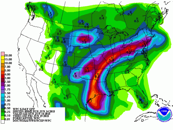
Once the tropical system moves northwestward it is likely to bring some heavy rain to the Texas Gulf Coast. This disturbance will dissipate and open into a weak trough and become caught up in the westerly flow Wednesday and Thursday. It could spell some heavy rain for portions of the Lower Mississippi River Valley. While ridging does maintain itself over the Southeast US coast, we may see an uptick in showers and storms into the latter part of the week with the potential for a weak cold front entering the Southeast US. The front should wash out fairly quickly leaving us with a broad ridge over the southern US and returning us to daily scattered showers and thunderstorms. Additional clouds and the weak front could knock temperatures back to highs around 90 – not much but we’ll take what we can get. This forecast is also predicated on the tropical system behaving as advertised, so there is some uncertainty in the forecast later this week.
Looking out into week 2, the GFS is maintaining the ridge over the Central Plains states which would keep much of the eastern two thirds of the country rather warm and toasty. Some hint at a weak trough affecting the ridge toward the end of June, but that seems pretty iffy.
I should have the next Weather Xtreme Video here on Monday morning while James Spann is on vacation. Be sure to catch the latest forecast on ABC 3340 at 5 and 10 pm this evening.
-Brian-
Category: Alabama's Weather


