The Deadly Barneveld Tornado
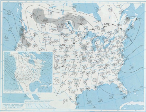
On the morning of Thursday, June 7, 1984, weather maps showed a major trough of low pressure across the western United States, anchored by an upper low over the northern Rockies. A long cold front snaked from Canada down through the Upper Midwest into the Plains. An occluded low pressure system was over southern Canada. A new low pressure system had formed to the south and was moving northeast off the plains of eastern Colorado. A strong complex of thunderstorms had moved through the Upper Midwest during the early morning hours, but across the region, the atmosphere reloaded quickly. Dewpoints were in the middle and upper 60s
By afternoon, an explosive situation was in place with high instabilities and increasing wind shear as the low pressure system intensified while moving toward the Upper Midwest. Thunderstorms broke out during the afternoon from Minnesota into Iowa. Tornado reports started to come in by mid-afternoon, where a rash of at least fourteen tornadoes plagued the northwestern part of the state.
Further south, other tornadoes touched down in Missouri. One family of tornadoes started near the Missouri/Iowa border. This supercell storm produced at least four tornadoes along a 140 mile path across much of Iowa. Three tornadoes were rated as F3s and one was rated F4 out of the afternoon activity. The F4 tore through the town of Wright, Iowa, killing two. The tiny town was completely leveled, with all 25 homes destroyed and all but two buildings destroyed. In addition, one person died near Ringgold, Iowa and three more in Harrison County, Missouri.
But the deadliest tornado of the outbreak would come during the early morning hours of June 8th. The complex of storms that had produced the long-track tornadoes in Iowa weakened during the evening hours. But as it moved toward southwestern Wisconsin, it encountered a higher level of instability and shear and the storms began to strengthen. A tornado watch was issued at 11 p.m. The first tornado touched down around 12:30 a.m., remaining on the ground for several minutes. A more powerful tornado touched down near Mineral Point. A few miles to the northeast, many of the 582 residents in the town of Barneveld were awakened by a massive clap of thunder right before the power went out. The town’s tornado sirens remained silent due to the power outage even as the huge F5 tornado roared toward Barneveld.
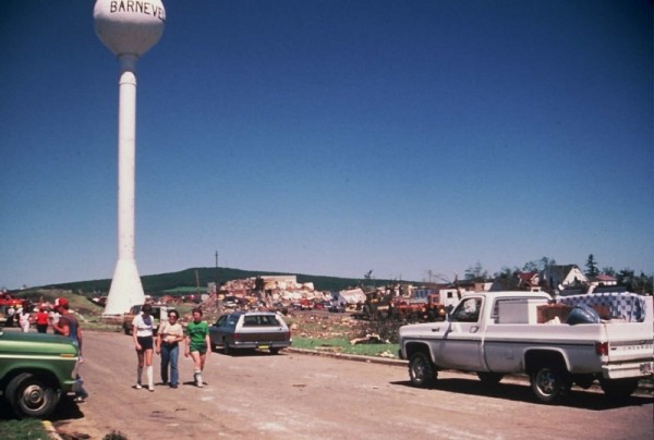
As the tornado ripped through Barneveld, it was at least 400 yards wide. When it finished its destructive rampage, 90% of the town lay in ruins. Seventeen of eighteen businesses were destroyed, as well as the municipal building, bank, post office, fire station and three churches. A total of 93 homes were destroyed and another 64 heavily damaged.
A total of nine people lost their lives in the inky blackness that night, while 200 were injured. The town’s water tower was damaged, but was the only thing left standing amidst the tremendous devastation.
For years, residents of the tiny town spent many a sleepless night listening to every rustle of the wind for the sound of another deadly nighttime visitor.
Category: Met 101/Weather History


