Scattered Storms Continue
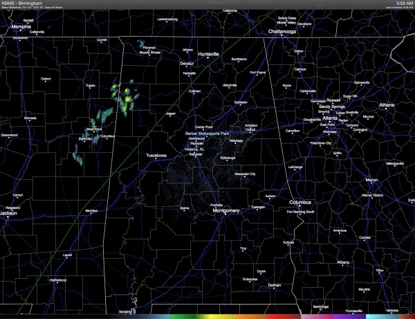
Quick check of the radar this morning shows a couple of showers near Hamilton in Marion County. Additional scattered thunderstorms are expected to develop in the heat of the afternoon, but they should be fairly widely scattered like we saw yesterday. Highs should climb into the middle 80s for much of Central Alabama.
The upper trough to our west will inch slowly eastward over the next couple of days, so this should help push a front into the area and this should allow an uptick in showers and thunderstorms for Sunday and Monday. With more storms and clouds, temperatures will drop back a little with highs in the lower 80s. SPC has much of the area along and just east of the front in a marginal risk area, so we might see an isolated severe storm or two, but the chances should be fairly low.
Beach goers will have to contend with passing showers from time to time, but there should be good intervals of sunshine, too. Water temperature has continued to rise with values near 80 degrees reported at the Dauphin Island Sea Lab site. Air temperature will run mainly in the middle 80s.
The forecast becomes interesting at mid-week and beyond. Interesting because of the presence of the front and also the GFS is developing a weak surface low in the vicinity of South Florida. The front could advance far enough south to allow some slightly drier air to make it into Central Alabama. And if the surface low develops near South Florida and moves off the Southeast US coast, it could also help to suppress convection. For now, the prudent forecast will be to include small chances of daily showers through the end of the week and into the weekend. With little change in heights, I do not expect to see much variation in daytime highs with values mainly in the 83 to 88 range.
For Oklahoma and Texas, the forecast drys out for them as the 5-day QPF forecast goes dry, and I’m sure they can use this spell of dry weather.
Tropics are quiet in the Atlantic for now while there is Hurricane Andres in the Pacific where it is expected to stay and weaken by the middle of next week.
Looking out into voodoo country, the GFS continues to keep the weather active. We see some weak ridging around June 8th, but by the 13th the GFS has developed a fairly deep trough over the eastern third of the country. While this looks somewhat wet for the eastern part of the country, it also means no extreme heat to contend with either.
I expect to have the next Weather Xtreme Video posted here on Sunday morning. Keep the umbrella handy, and heed any lightning that should occur in your vicinity. Do not become a lightning statistic – be safe!
-Brian-
Category: Alabama's Weather


